Gail - from the Schütt to Lake Silbersee
Address
Schütt
GPS
46.563994622398, 13.761491775513
Level of difficulty 3 | Gastronomy 1 | Length 15 km | Time 2.5 - 3 hours

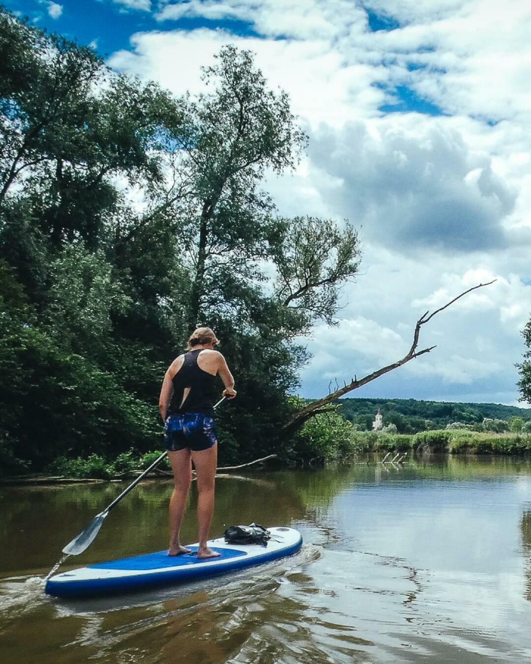
The Gail River is known for its crystal clear and cool water. If you want to avoid the whitewater on this river, the best thing to do is paddle its last thirteen kilometers to where it flows into the Drave, enjoying various minor challenges and a great view of the Karawanken mountains.
General information
- Carinthia Card
- Villach Wikipedia
- Villach tourist information
- Paddling Town
- Gailtal Valley tourist information
- Gail Wikipedia
- Climate
- Wind, waves, weather


Navigation rules
Only head for the banks for short breaks and behave quietly so as not to expose the animals to unnecessary stressors. Always take rubbish with you!
On the Drave (Drau River) passenger ships always have priority.
Dangers and risks
The Gail River has pleasantly navigable tame water along the entire route with some light whitewater passages and surges.
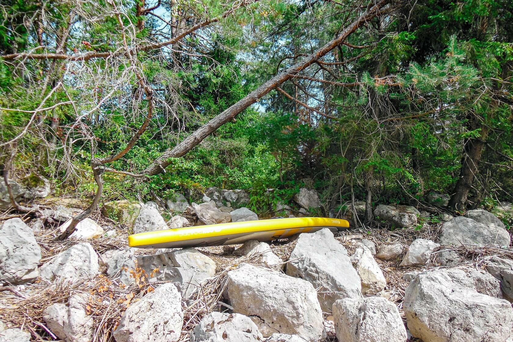
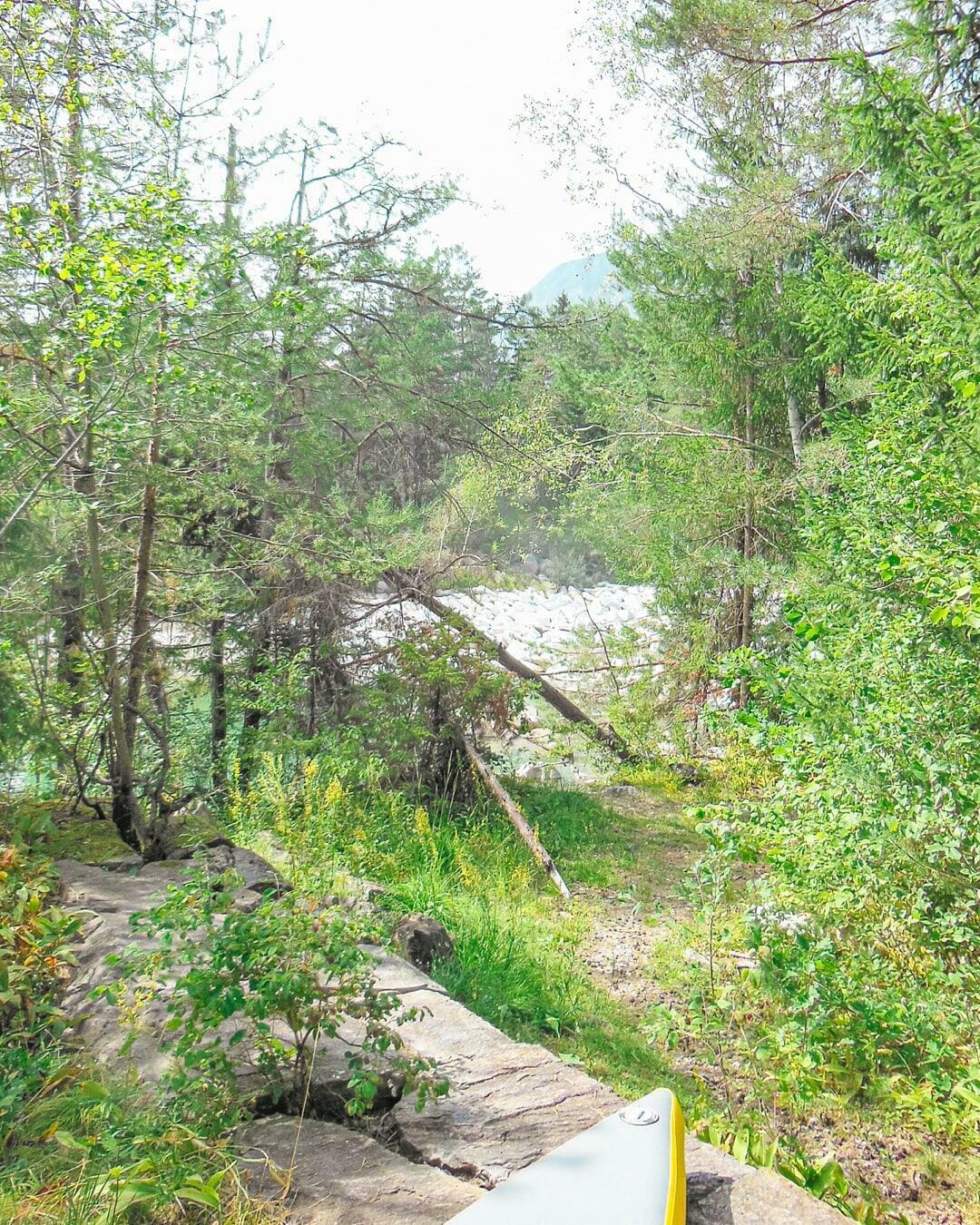
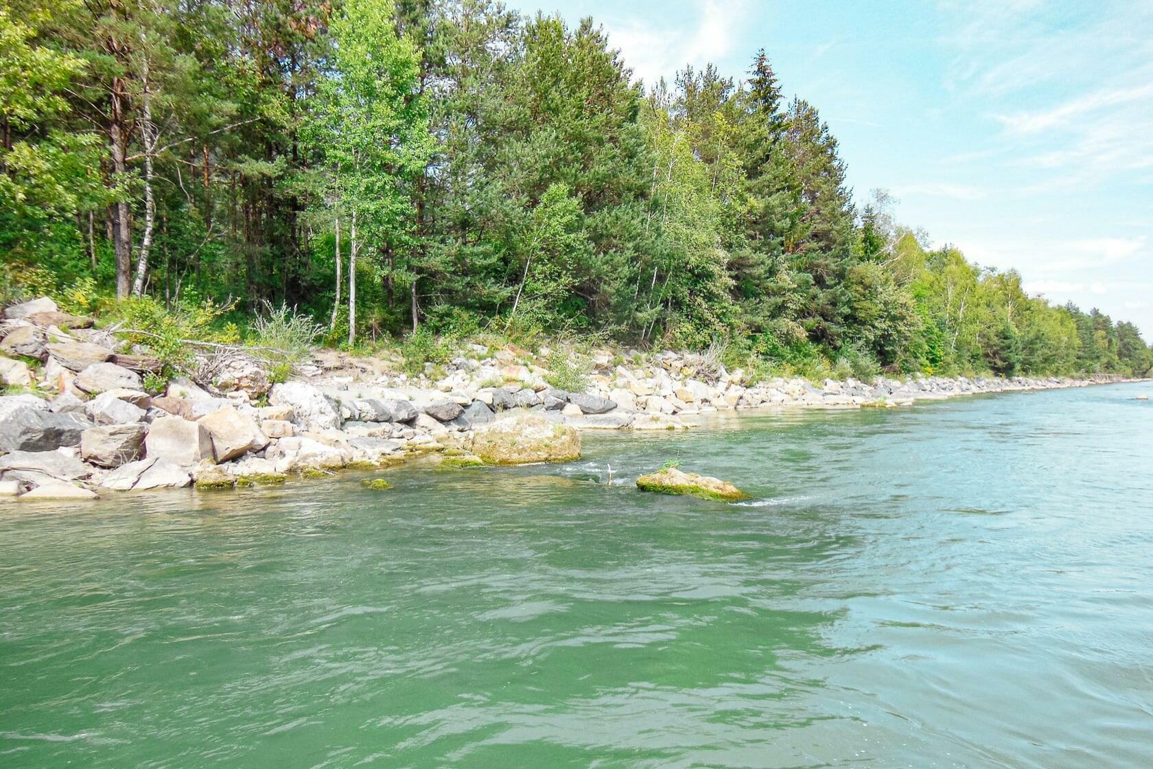
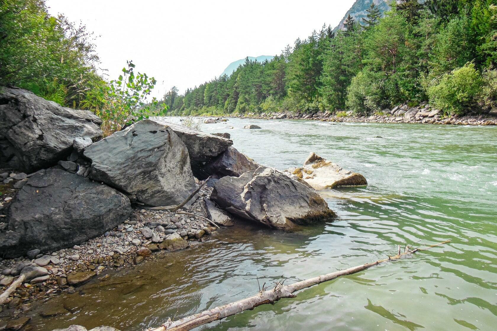
The access is a bit rocky and the pool between the heaped up rocks at the so-called White Stones of the Gail is quite shallow towards the motorway bridge (indicated by the brownish shading of the water on the satellite image). Once in the water, you probably have to walk about a hundred meters and carry/push the board over the rock embankment. This already shows that good neoprene or bathing shoes with non-slip soles are indispensable, because it can also be necessary to wade through the water over the smooth stones in other places along this tour.
There are a number of shallow passages along the entire route, but these are passable. In extreme cases, simply shift the weight to the front third of the board to get the fins up in the back.
Under the jetty at the snack station called Gailstüberl a groundsill is formed that can only be negotiated via the middle. To do this, you paddle just to the left of the central pillar and find a passable gap between the rocks ahead – keep your knees relaxed and paddle through with body tension.
Alternative: wade to the left through the shallow river bed and get back on after the footbridge.
Another groundsill is located in front of the sandbanks after passing the railway bridges at Gödersdorf. The threshold on the far right is fairly okay to paddle, but expect a water landing under certain circumstances. Otherwise, turn left early enough, wade through the shallow water and carefully carry the board over the threshold close to the bank.
Just before getting into the Villach urban area, the water can become choppy again near the sandbars around the barbecue area. Here fishermen like to stand in the river while doing their job. So keep your eyes open and take evasive action in good time!
If you paddle on the Drau and the Gail in spring, you have to expect very cold meltwater. Snowmelt can also cause more turbulent flow due to the additional water in the sections west of Villach.
Passenger ships operate on the Drave, so please make way in time!
Directions
Coming from Villach, take the Kärntner Straße B 83 south of town (Udine, Wurzenpass, Tarvisio) and turn right after Warmbad in the direction of Schütt (Wurzenpass, Tarvisio junction). Just before you drive under the motorway bridge (A2), turn right again towards Schütt/Oberfederaun/Unterfederaun and follow the Schütter Straße Street for about five kilometers until you have passed under the A 2 motorway bridge and are level with the gravel banks and the so-called White Stones of the Gail where you will get on the water. Park or get off at the few and hopefully free parking spots along the roadside.
Parking
Parking is a bit difficult around the starting point of this tour. Along the Schütter Straße there are a few single parking spots on both sides of the street, but these can already be occupied on nice days.
Preferably you let yourself be driven there so that you don't have to park your car yourself. No matter where in this area you get on the Gail, you will always have to find a parking space by the road side and then a footpath through a green belt.


Swimming
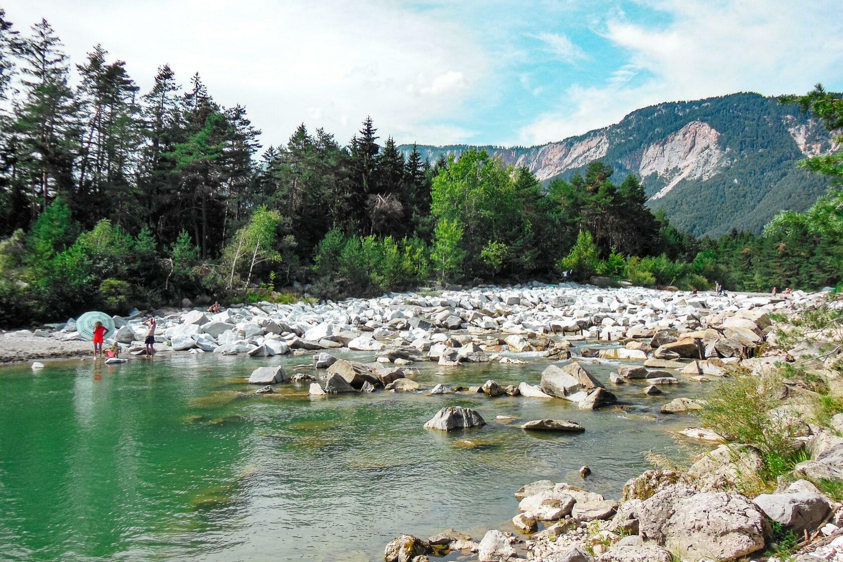
The Gail is actually known for its cool mountain water, however the water temperature can get surprisingly warm in midsummer. In the Schütt people enjoy the relatively cool and clear water on countless sand and stone banks between the power plant and the white stones. In the dammed pools you might get surprised by lake temperatures of over 20° C in midsummer.
Along the entire route you will always find access to water, sandbanks, and in the Villach area several bathing spots with parking facilities in front of them, and all of this is free of charge.
The Drava River often has brown water in summer and is not always as clear and inviting as the Gail due to the sediments it carries. You can also get into this river at suitable water access points along this route, as the river speed tends towards zero in many places.
In the Villach area there are also a number of bathing opportunities outdoors as well as the indoor baths Kärnten Therme (Carinthia Thermal Baths) and Warmbaderhof in Warmbad.
Tour
From the so-called Schütt in a northeasterly direction to Lake Silbersee.
Length
15 km
Time
2.5 - 3 hours
Start and landing
Start at the White Stones of the river Gail near Oberschütt.
Land at the ship pier on the Drave near Lake Silbersee.


SUP rental
Kanupanzi
Vorderberg 144, 9614 Vorderberg
Phone +43 (0)4256 29196
Fels & Wasser
Flurweg 20, 9524 Villach
Phone +43 (0)650 6161327
Kayak Center Faak
Am Sonnhügel 1, 9583 Faak am See
Phone +43 (0)650 41 022 71
Drau Paddelweg
Dahlienweg 14, 9161 Maria Rain
Phone +43 (0)463 2032 30100
FreizeitBASE
Drauterrassen at Lagana am Fluss
Phone +43 (0)463 203230100

Entertaining ride over clear water
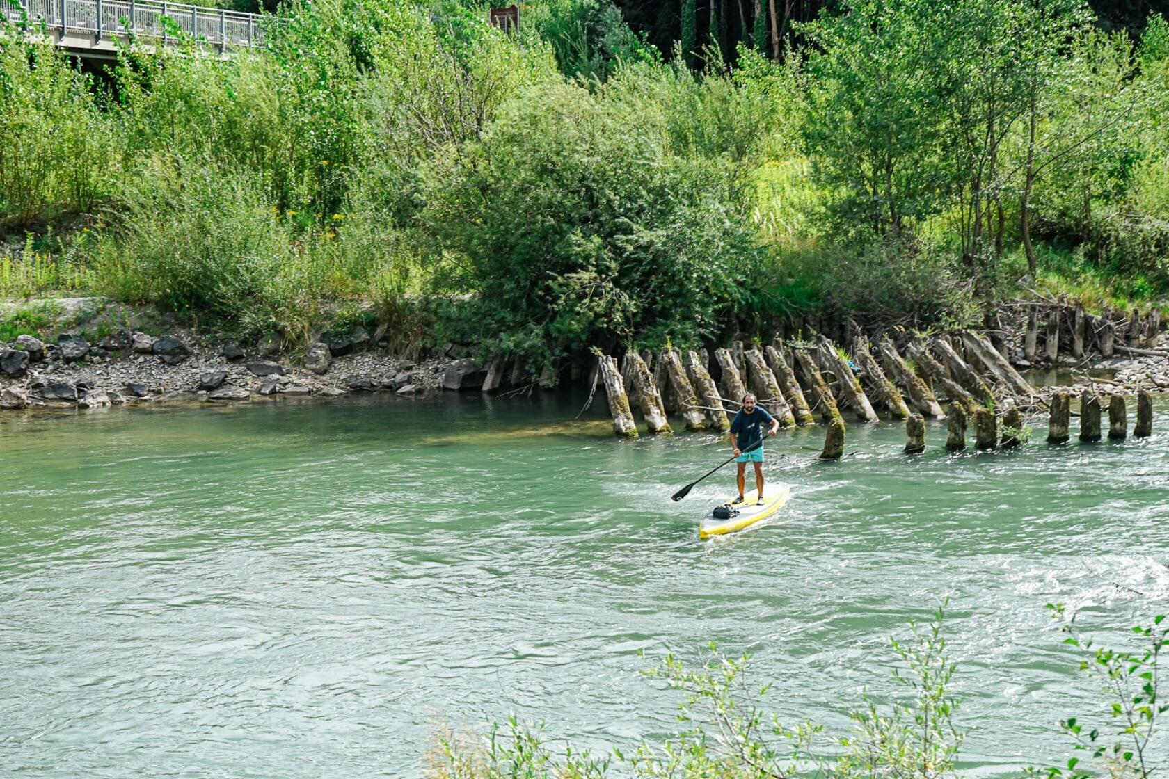
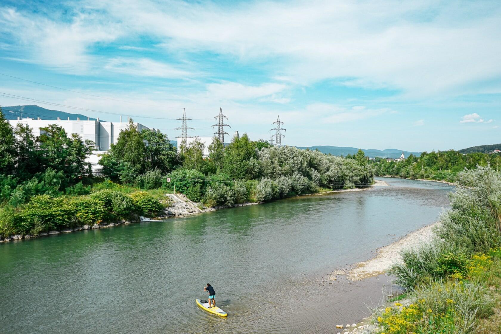
The Gail River is the longest right tributary of the Drave River an rises from the East Tyrolean Gailtal Valley. After 122 km it passes the so-called Gailspitz near Villach and flows into the Drave. Unfortunately, at the end of the 19th century, the river began to be regulated over large areas, so that the section under the old power plant Schuett 1 and the Gailspitz has lost a lot of its meandering naturalness.
Nevertheless, a paddling tour up to the Lake Silbersee is a lot of fun and offers largely lonely sections with some easy white water. The search for a suitable entry is already adventurous, because after the power plant Schuett 1 which was renovated in 2018/19, the river is mostly dry in the area of the Schütt over a distance of approximately 4.5 km. Up to the power plant, the river is still quite natural and sometimes impetuous. Due to the regulation, the largely drained Schütt is not navigable, but a popular natural bathing area. On nice days sun worshipers and water lovers bask between the banks and rock outcrops.
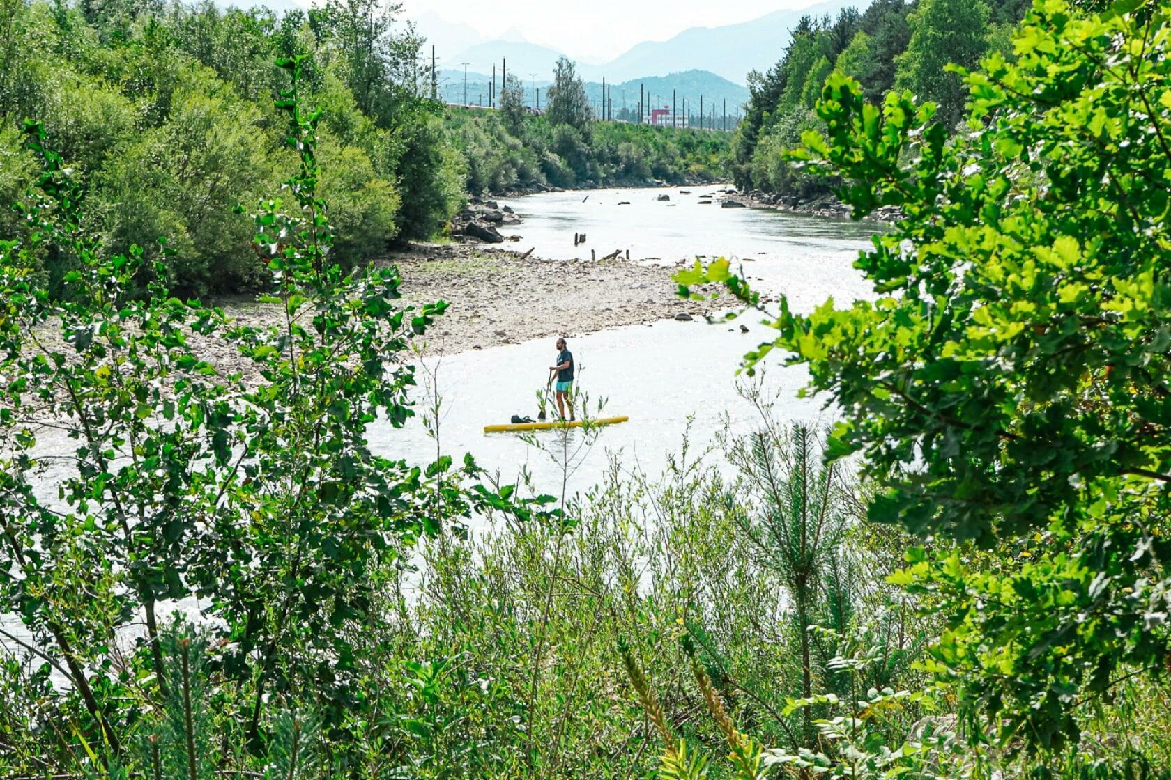
I choose my starting point at the lower end of this zone at the White Stones of the Gail, at the foot of Mt. Dobratsch. To do this, I have to be taken to Schütter Strasse, as it's hard to find a permanent parking space here. There are some paved parking spaces along the road, but not optimal conditions for long-term parking.

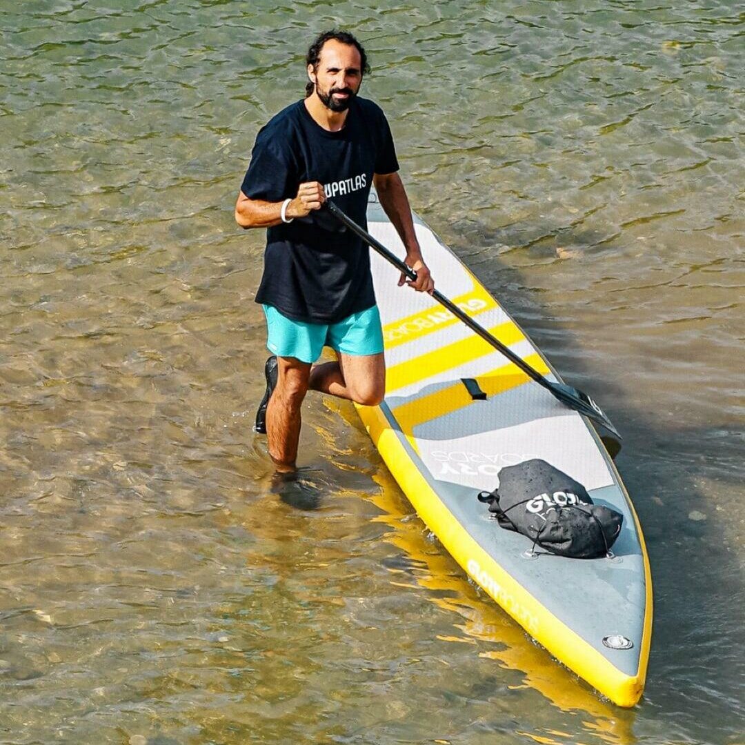
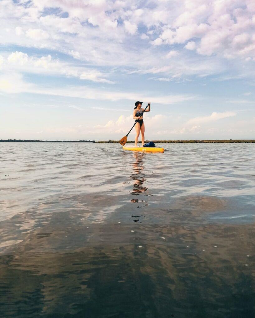
A small dirt road leads to a stone wall and from there past the trees to the pool under the white stones of the Gail. Opposite, swimmers have built their day shelter and are curiously watching me getting on my SUP. You can paddle a few meters downstream, but after that you have to dismount and wade through the water to pull the board to and over the following rock outcrop. The rocks on the ground are consistently slippery, which is why bathing shoes or neoprene shoes are essential.
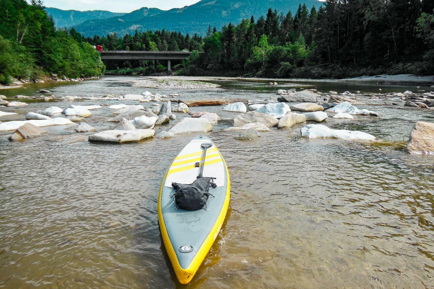
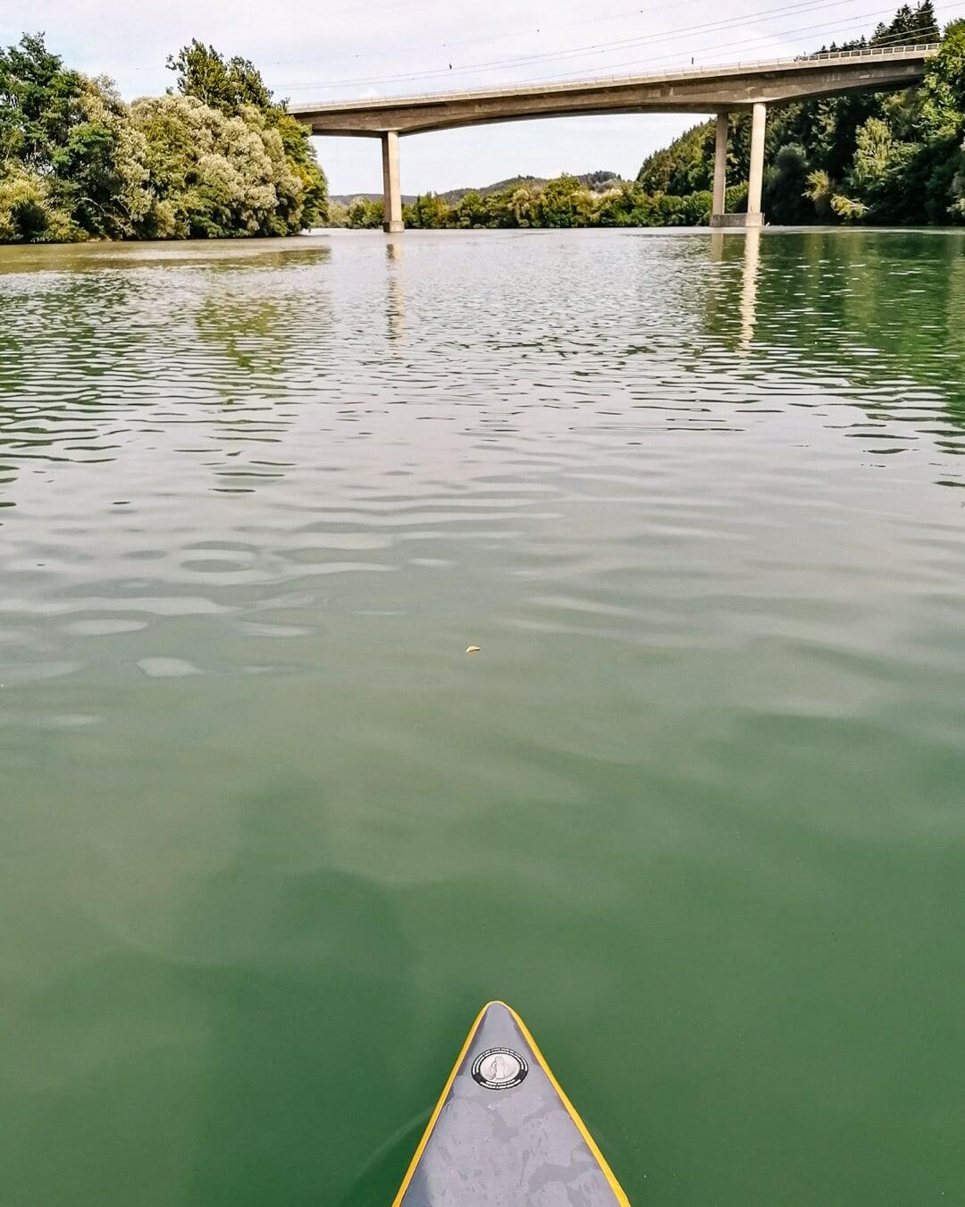
Starting at the motorway bridge of the A2 motorway, the Gail finally shows river character and the next 1.5 km you can paddle towards the pedestrian bridge at the snack station Radlertreff Gailstüberl pretty comfortably.
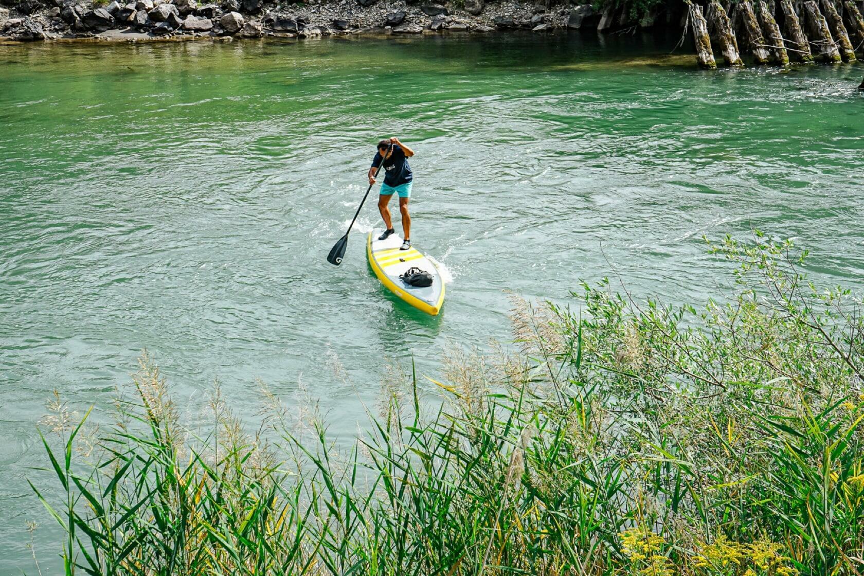
Due to the straightened course of the river, the small bridge is visible from afar and you can prepare yourself optimally for paddling over the sill below. To do this, you should approach just to the left of the middle bridge pillar and pull straight ahead over the threshold. As an alternative, you can also carry the board over the stones on the shallow left bank.
No matter which variant you choose, you can be sure that cyclists and hikers who have stopped will be staring at you. From here a cycle path leads to the Villach suburbs up to the Warmbach, which comes out of the thermal area Warmbad/Villach and makes its way to the public bathing beach Gail just a few kilometers down.


The next two kilometers on the river are unspectacular, until you come across a 200 m long passage with boulders scattered in the water, which create nice little surges and turbulences. Here you can slalom and indulge in the high entertainment value of this passage before the river continues again quite inconspicuously.
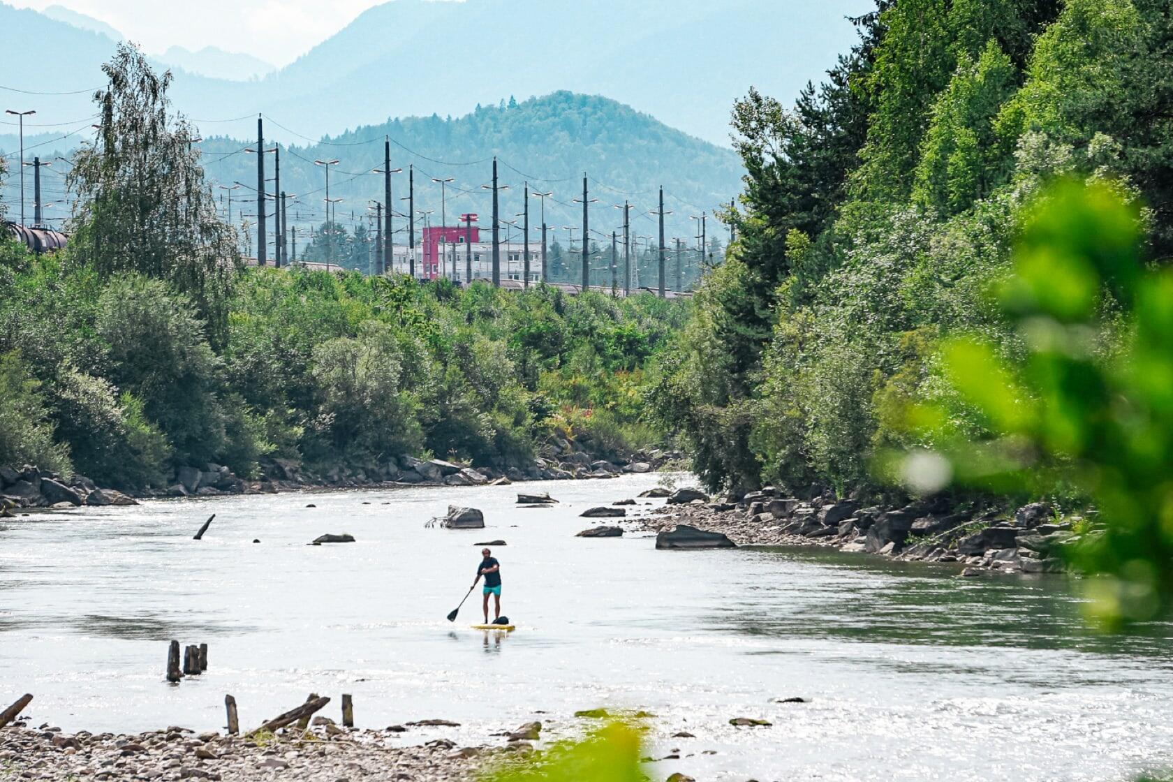
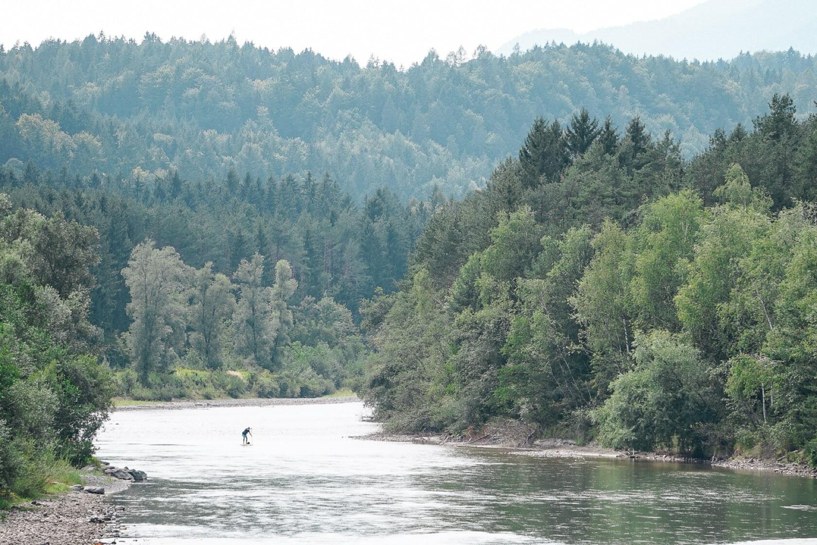
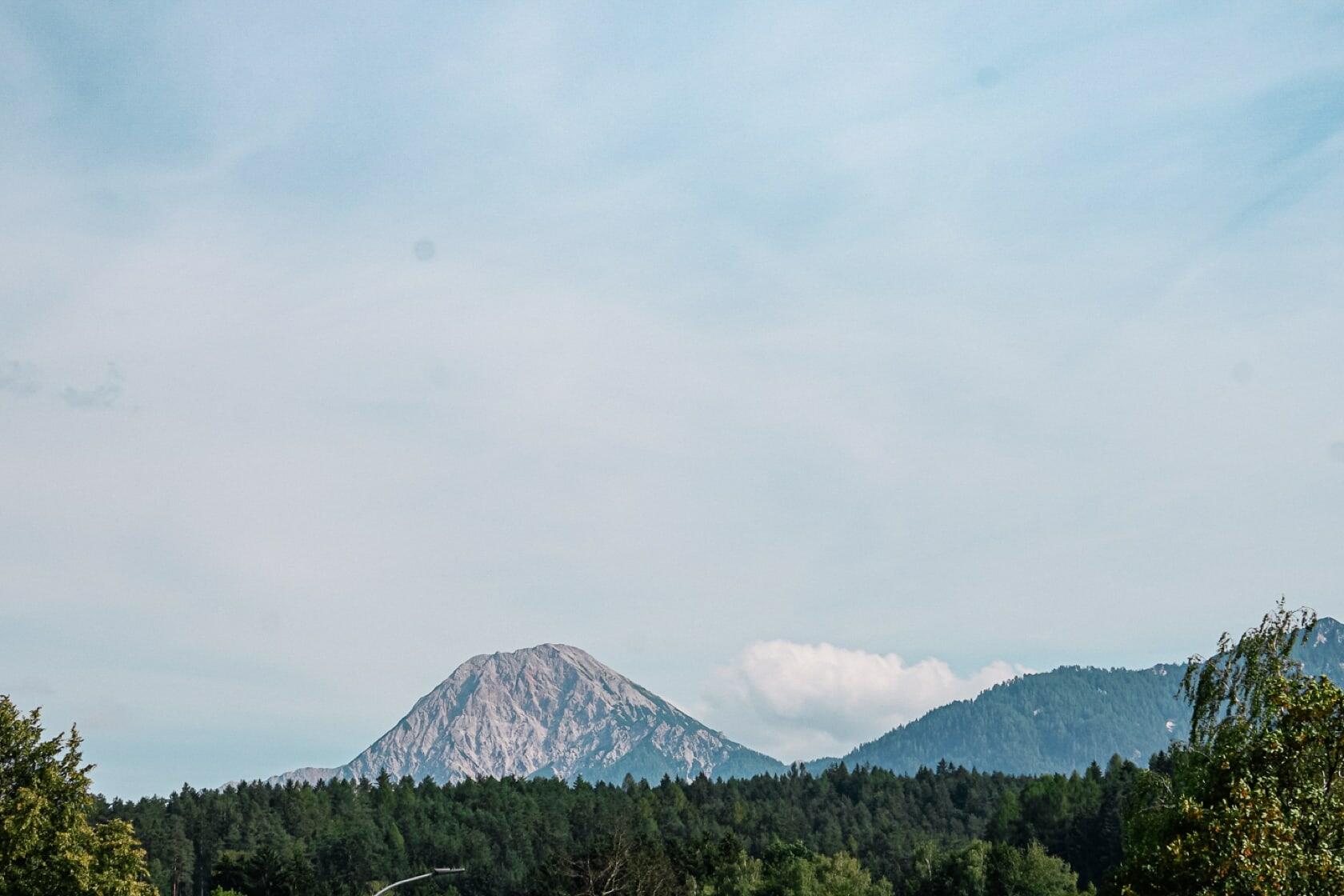
Time and again gravel banks and the view of the Karavanks alternate. Especially the high Mittagskogel attracts attention again and again with its supposed summit plateau. However, anyone who has ever been up there knows that it is actually not a plateau but rather a ridge that you climb.
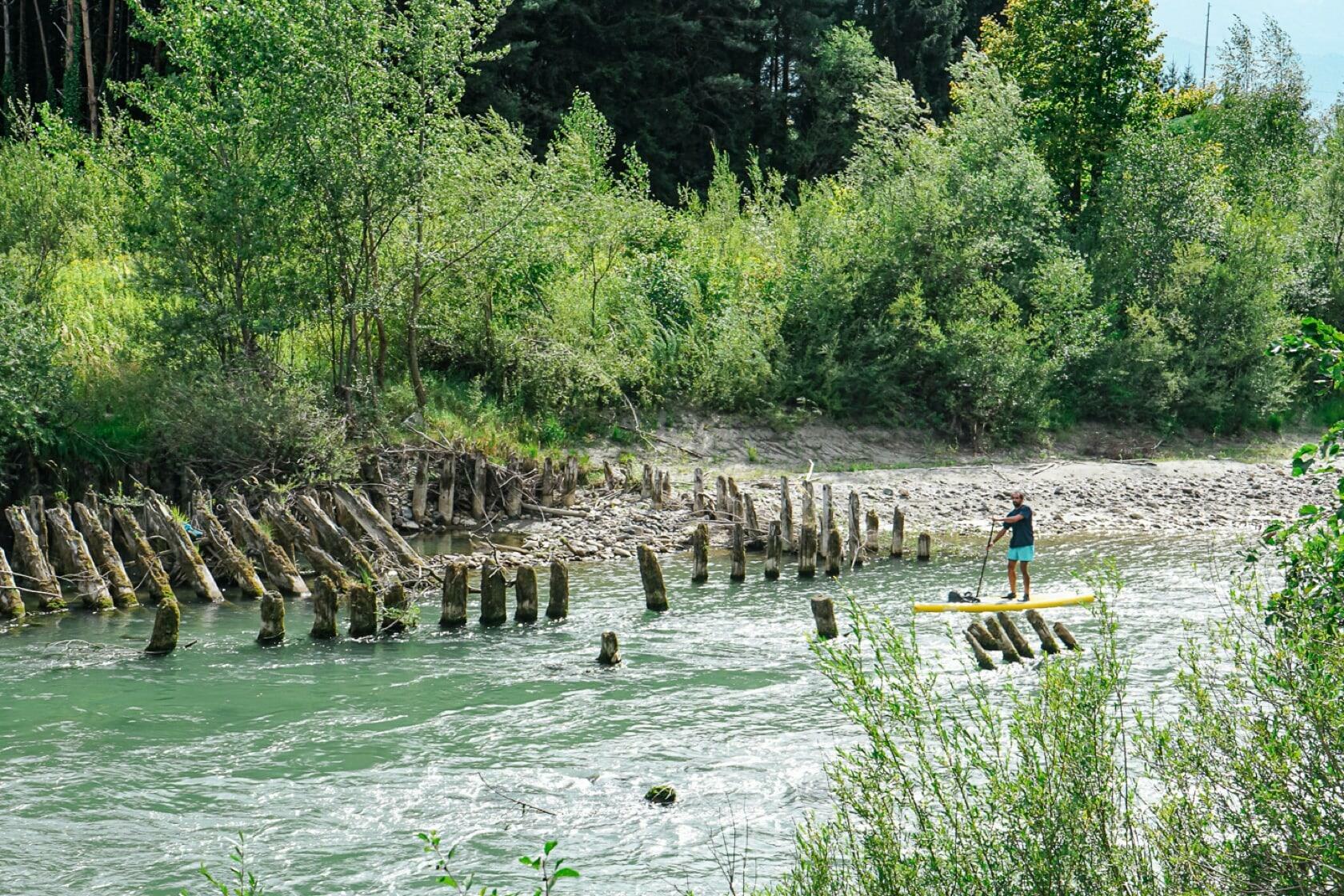
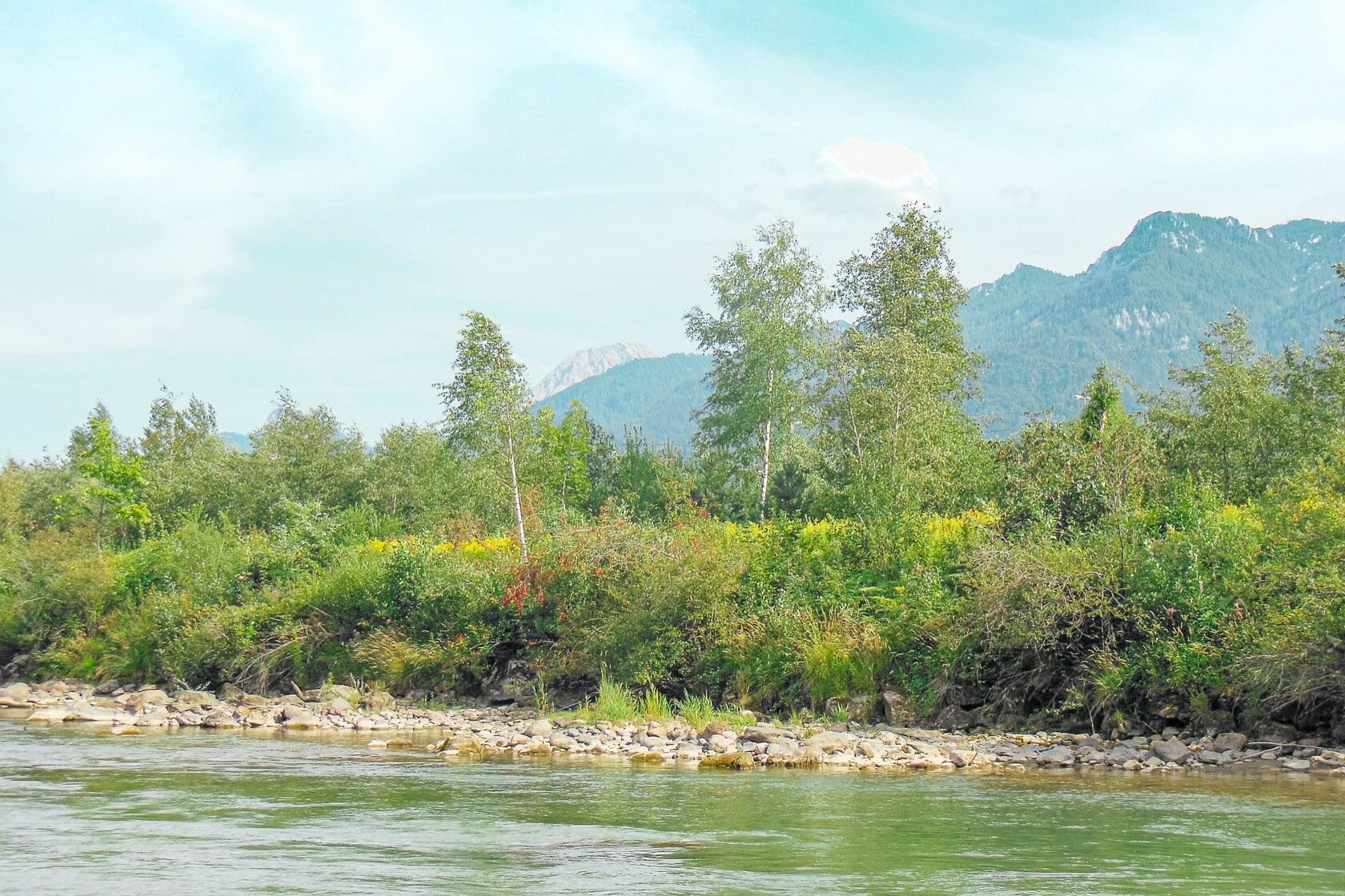
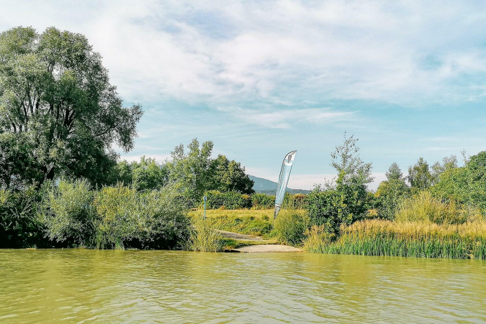
Near Gödersdorf I pass three railway bridges and get closer and closer to the city of Villach. After the bridges, there is a left turn and the Gail meanders - possibly following its original course - into the city and on to the Drave. Again and again I paddle past splashing families, recreational athletes and fishermen. Here many shore sections are easily accessible and allow you to park your car.
A larger sill, which is passable on the right follows, and about 200 m further downstream another smaller sill, which is best conquered on the left. If necessary, you can simply kneel or sit and let yourself be pulled over the thresholds, but you cannot completely rule out the possibility of a water landing. Classic river paddling action!


After another right turn the water becomes choppy yet again by the gravel bank in the area of the Warmbach Stream. If you managed to make it this far, you can easily get over this passage and consequently glide through the Villach suburbs of Tschinowitsch and Maria Gail and on to the Gailspitz - the point at which the Gail flows into the Drave.
From the bridge in Tschinowitsch at the semiconductor plant of Infineon the flow decreases significantly, so that towards the Gailspitz you have to pull your paddle harder in order to get ahead. This does not change anymore as soon as the clear water of the Gail has mixed with the sediment-rich water of the Drava and you are on your last 1.5 kilometers to the Silbersee lake.
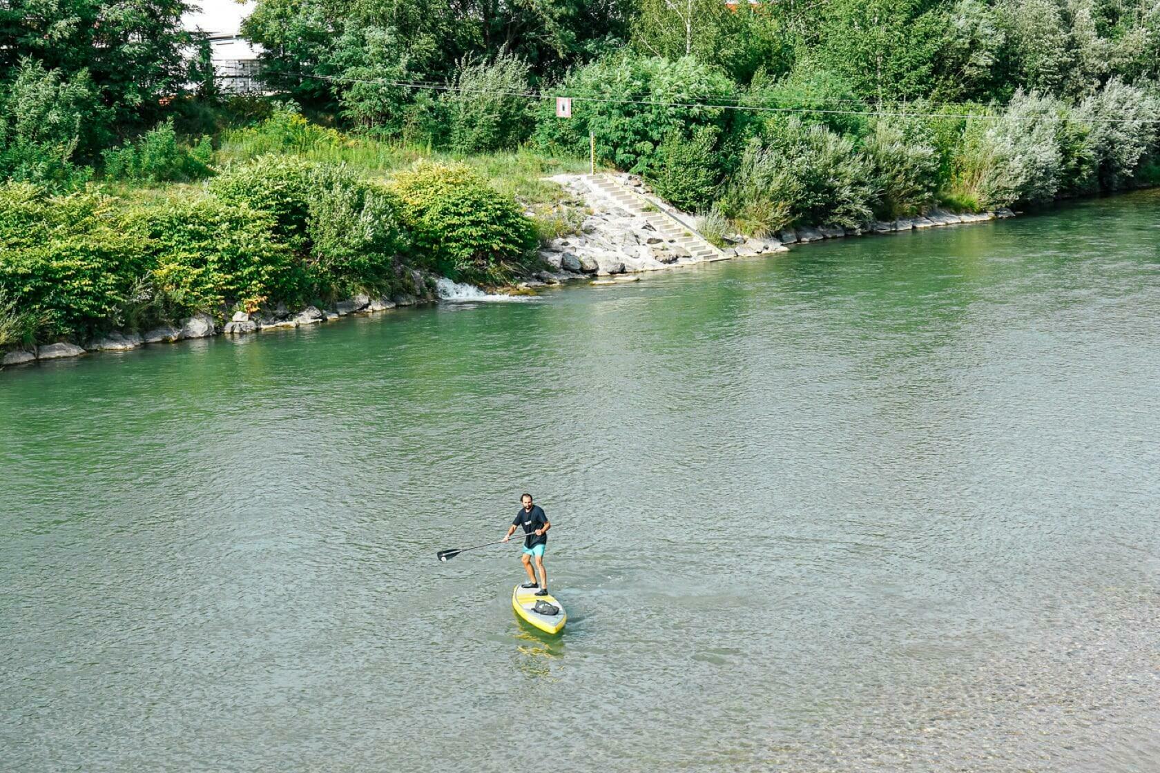
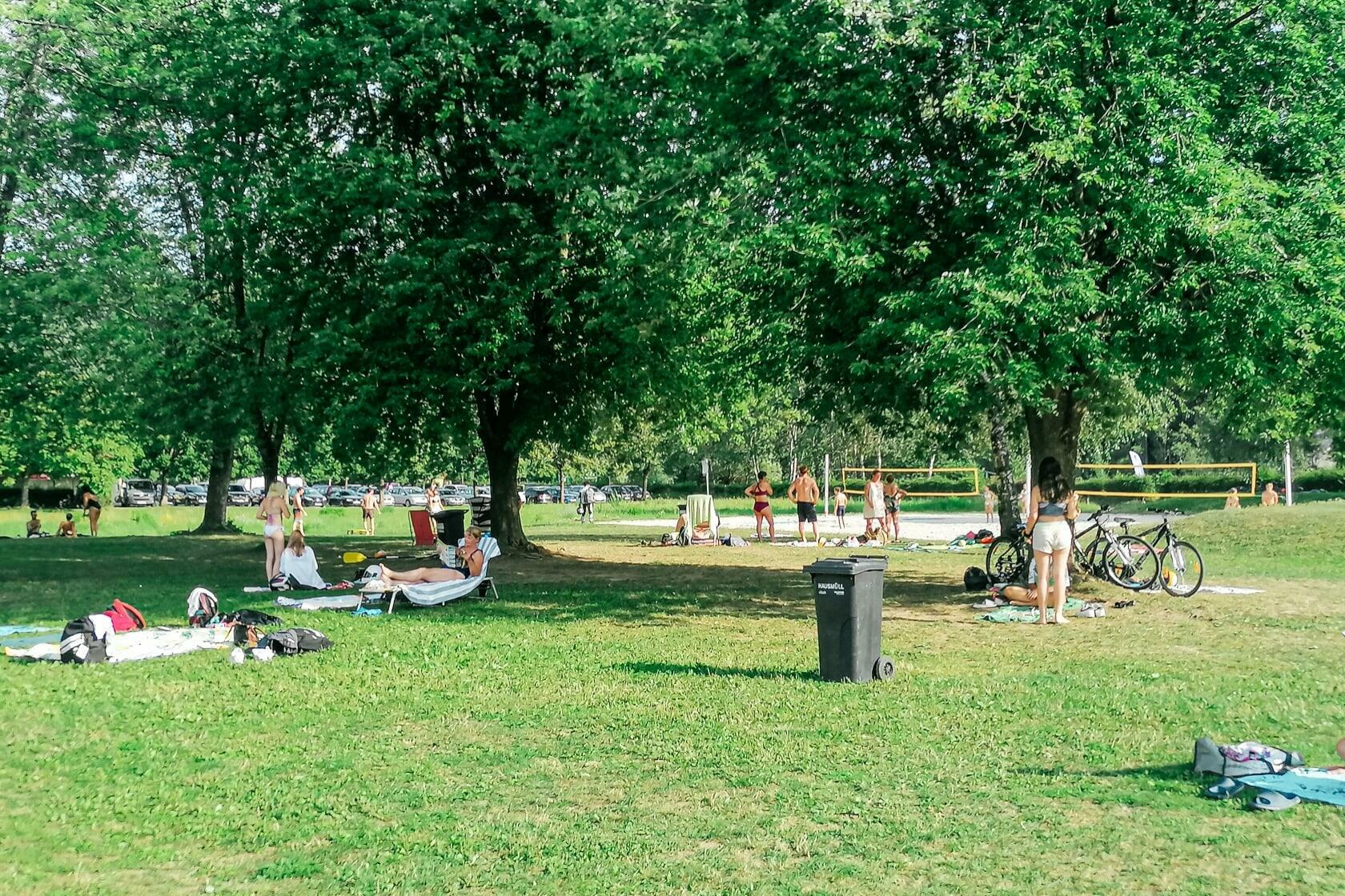
The small Lake Silbersee is a popular gravel pond east of Villach and is in close proximity to the left bank of the Drave. I conclude this river tour at the ship dock and review the last 15 km in my head sitting on the bathing lawn while watching some SUP paddlers splashing in the lake.
At the lake there are two paid parking spaces (in summer) where you can park your car in advance. For getting back you can also take bus line 3 which takes you to the Villach main station within a few minutes. The bus stop is at the road junction to the lake.


Alternative 1: Of course, this tour doesn't have to end at Lake Silbersee, because you can still paddel to the municipality of Rosegg and land there at the power plant. The power station can be crossed on foot and by bike. There is a parking lot on the left side next to the facility and a bus stop to the right of it (in the direction of river).
Alternative 2: At the Geilspitz you can also turn left into the Drave. This means you can paddle upstream to the center of Villach (4.3 km) or even further to the next power plant (7.2 km). This variant corresponds to a section of the route Silbersee – Villach.
You can find more beautiful paddling tours in the Villach area in the SUP Guide Carinthia.


Leave a Reply