Annabrücke Reservoir
Address
Annabrücke Reservoir
GPS
46.544398977147, 14.304006099701
Level of difficulty 3 | Gastronomy 1 | Length 13,5 km | Time 4 - 5 hours
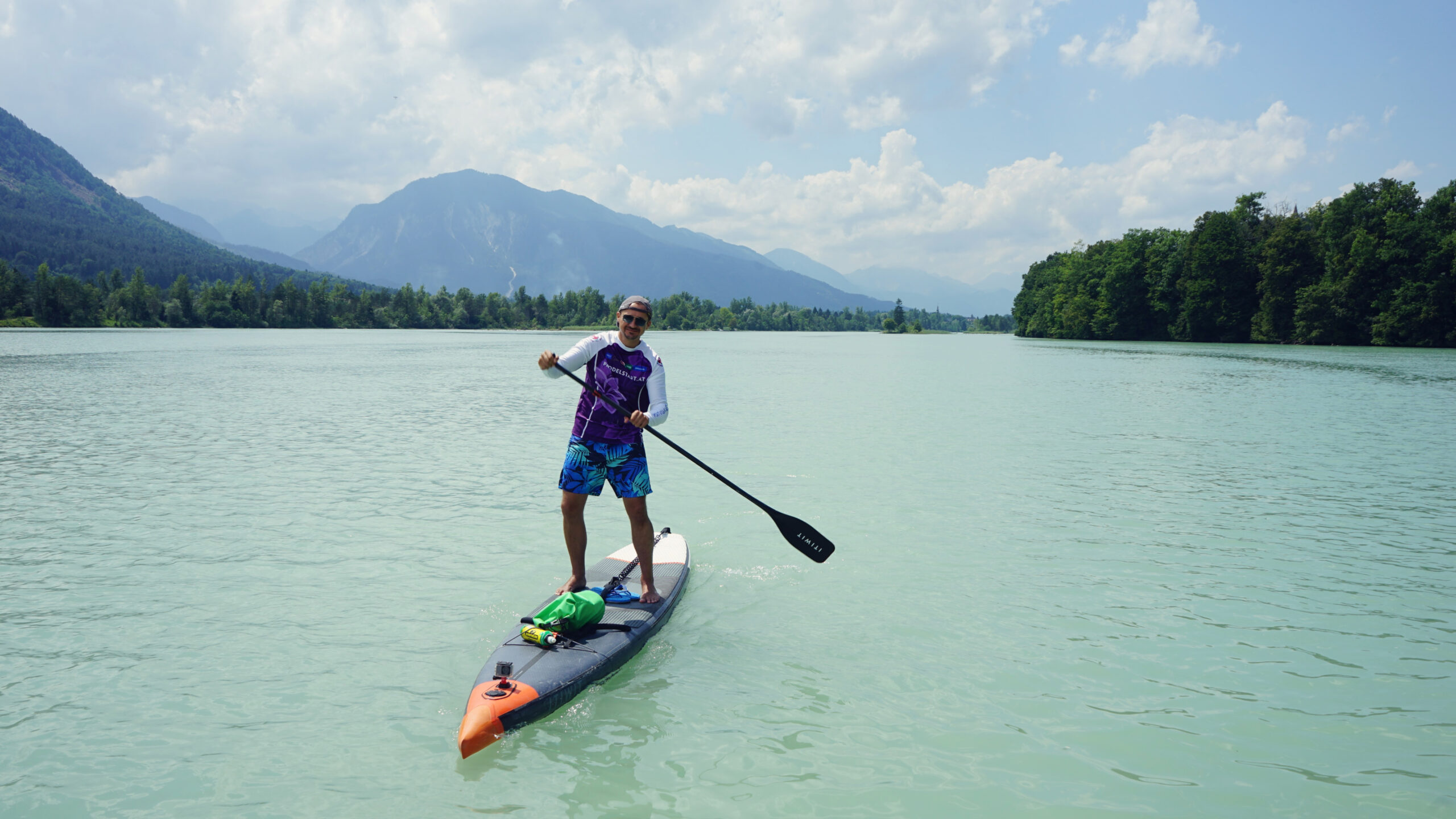
The Annabrücke Reservoir is an exceptional phenomenon thanks to its many faces. The Drava River becomes an inland sea with islands, floodplains and lagoon landscapes, secluded bays and Wild West panoramas.
General information
Navigation rules
After the first three kilometers along the river you will come across the Valentine's Ferry, which takes hikers and cyclists from one bank across the Drava to the other. If it is on the move, please give way!
Be quiet and respectful, especially in the Guntschacher Au nature reserve! Please do not paddle through the floodplain area and take any rubbish with you! The same applies to all islands and reed areas in the reservoir.
The left bank is often lined with dozens of fishermen in the area of the bridge. Please avoid them as well as all fishing and leisure boats along the way!
Dangers and risks
If you choose the first option to enter the water you have to overcome a steep and rocky bank. It is not particularly dangerous, but you must be sure-footed and cannot easily enter the water at the bottom of the descent. Everything must be done carefully and thoughtfully.
The second and slightly easier way to get in is at the end of the trout farm on a small path down to the water. It is easily recognizable by the wooden railing next to the roadside and also leads down over rocky terrain. The ground on the bank can be muddy in some places.
The left bank in the area of the bridge is often lined with dozens of fishermen, who you should avoid. Also avoid all kinds of fishing and leisure boats along the way!
The Valentine's Ferry in Glainach regularly takes passengers from one bank of the river to the other. Therefore, paddle with foresight and give priority to the ferry when it is operating!
The reservoir is large, but every now and then you may come across small boats, which of course can also cause some waves. If you are unsure, avoid the boats and thus the waves as much as possible.
The tour can be completed on either side of the Drava, but you should preferably go to the left bank, as there is a path up there that then leads down to the car. The exit on the left is steep and about a meter high, but you can move at a safe distance from the dam. On the right there is more forest and the landing is actually right next to the dam - not ideal.


Directions
From the north – for example from Klagenfurt – you can take the B91 to the Ferlach-Maria Rain power station, where the tour starts.
From the south – for example from Slovenia – you reach the power plant via the Slovenian E652 and the Austrian B91.
Traveling by bus is not recommended due to insufficient connections.
National and international bus, train and flight connections can be found via the comparison portals Omio, Busbud as well as RailEurope. If you arrive by plane, you will either land in Klagenfurt or in Ljubljana.
Parking
This tour is best done by shuttle, as public transport is poorly developed. The following options are available for starting the tour:
You can park for free right next to the Ferlach-Maria Rain power plant. From there, walk about 400 m to the steep, but closer water access. The easier access is another 300 m away.
If the free parking lot is full, you can also park at the slightly further away lake Reßnig See for a fee (free of charge from September to April), but it is about a kilometer further away.
At the other end of the tour, it is best to park under the dam and in front of the driveway to the dam crest. There should always be some space available.
In exceptional cases you could park at the parking lot of lake Linsendorfer See. It is also free, but over 500 m further away.
Swimming
In midsummer, when the air is around 30°C warm, expect water temperatures of around 15°C in undammed areas of the Drava. So it's great for cooling off. Away from flowing water sections the water is a bit warmer and you can always get off the SUP and jump into it. From time to time you can also see people going into the water from the bank.
If the water of the reservoir is too cold for you, go to the lakes Linsendorfer See, Reßnig See, Ratzteich or the Freibach Reservoir instead.
Tour
From the parking lot under the Ferlach-Maria Rain power plant to the Annabrücke power plant.
Length
13,5 km
Time
4 - 5 hours
Start and landing
Start on the right bank under the
Ferlach-Maria Rain power plant.
Land left before the Annabrücke power plant.


SUP rental
Draupaddelweg
Dahlienweg 14, 9161 Maria Rain
Phone +43 (0)463 2032 30100
SUP2GETHER
Mobile SUP rental
Am Birkengrund 26, 9073 Klagenfurt
Phone +43 (0)463 20323020
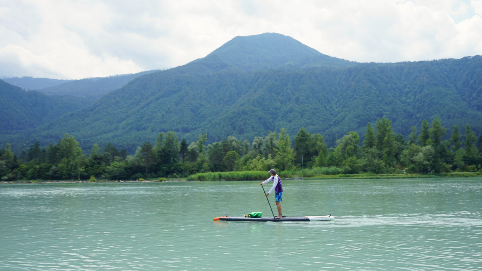
Inland sea with Wild West atmosphere
It is quite remote, the Annabrücke Reservoir south of the Carinthian capital Klagenfurt. If you are coming from the north, you first have to drive along its south side to park a car at the tour start. Without a second car, nothing works here due to the poor bus connections. You park it at the other end of the reservoir under the Annabrücke power station.
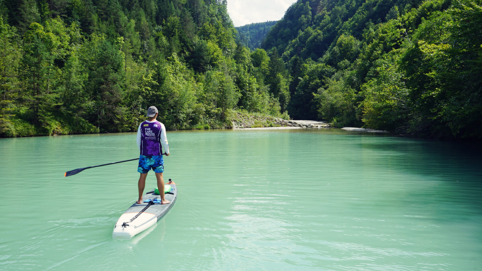
This paddling area is huge, but the entry options are limited along the south bank of the Drava River, as the bushes and rocks under the Ferlach-Maria Rain power plant severely restrict the descent to the water. We opt for the more comfortable water access, but further away from the car park, and enter the small path with wooden railings by the trout farm.
At the bottom the terrain is flat, but at least today, muddy. A fisherman is packing up his gear and we are lucky that there are no more fishing rods sticking out into the water. That would make it difficult to get in, especially since there are only a few halfway decent spots where you can put your SUP in the water.
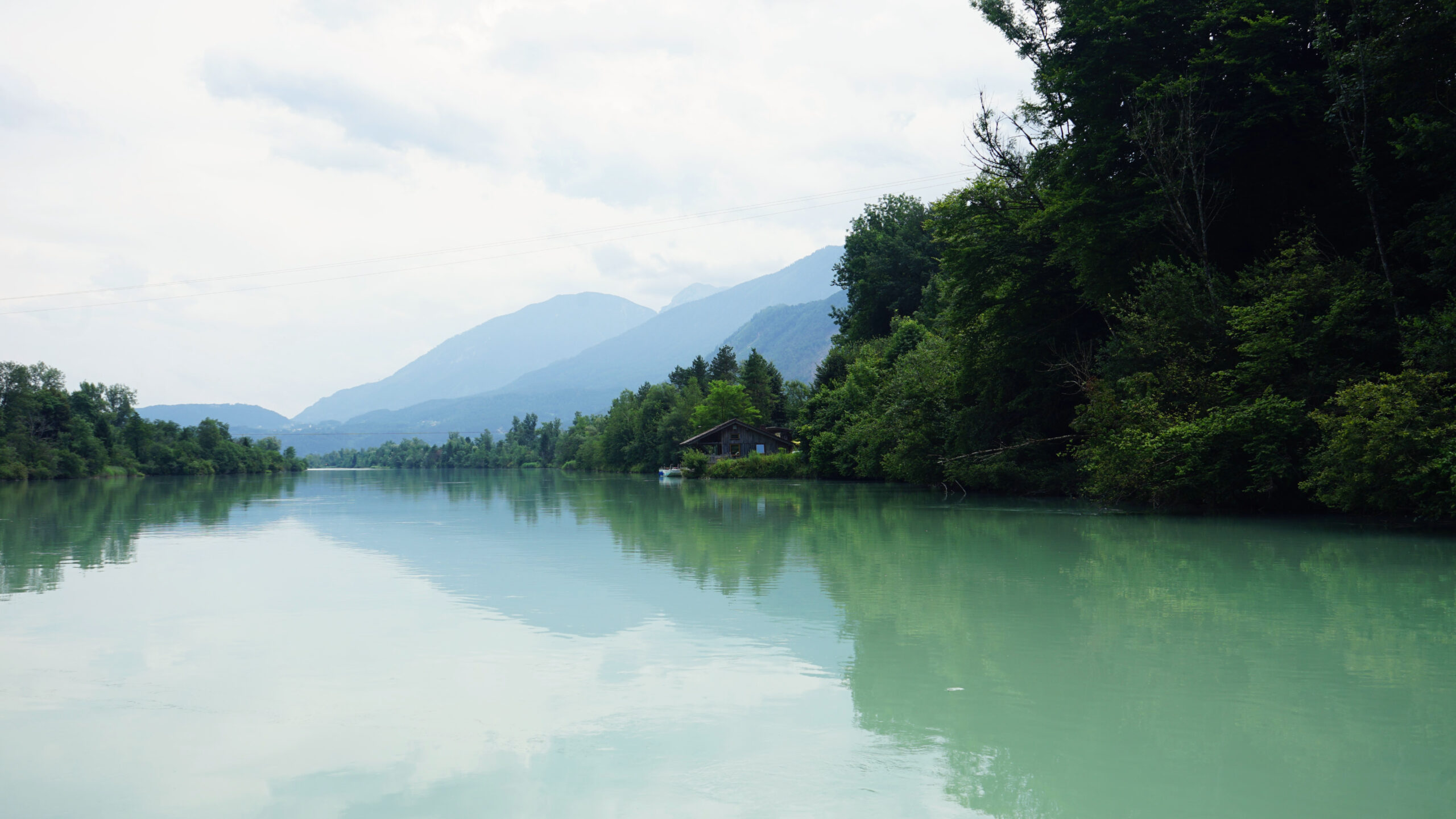
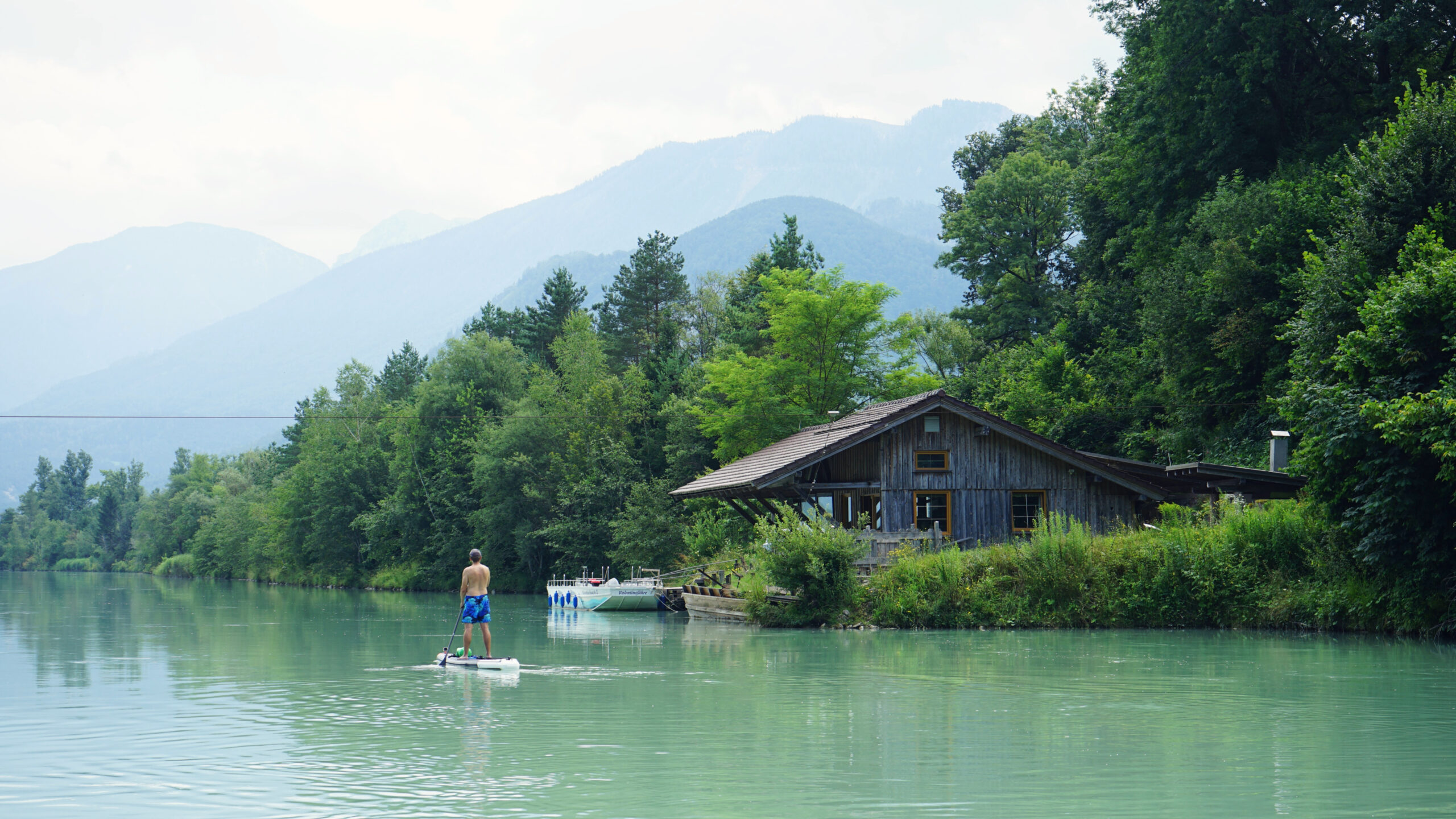
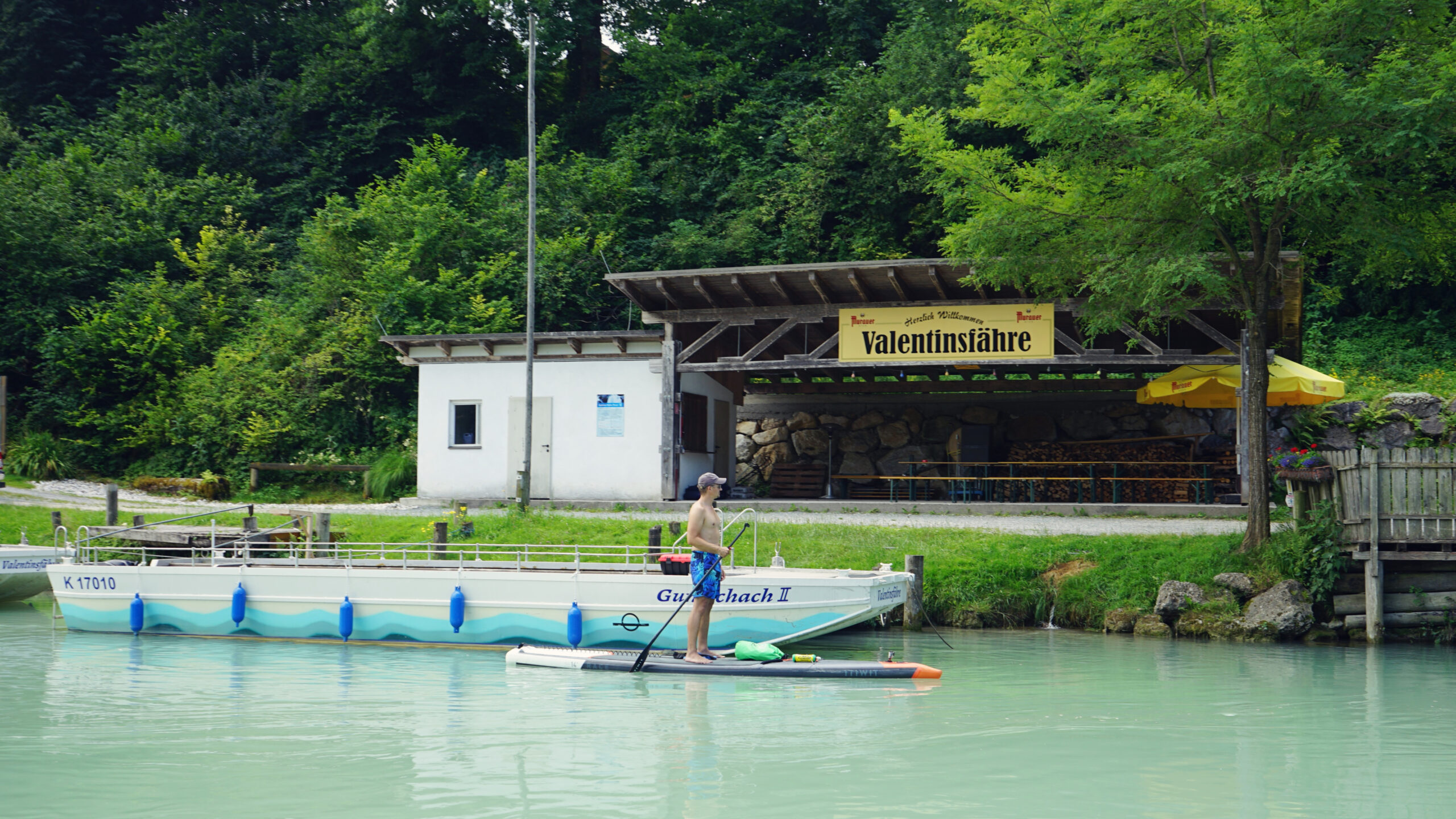
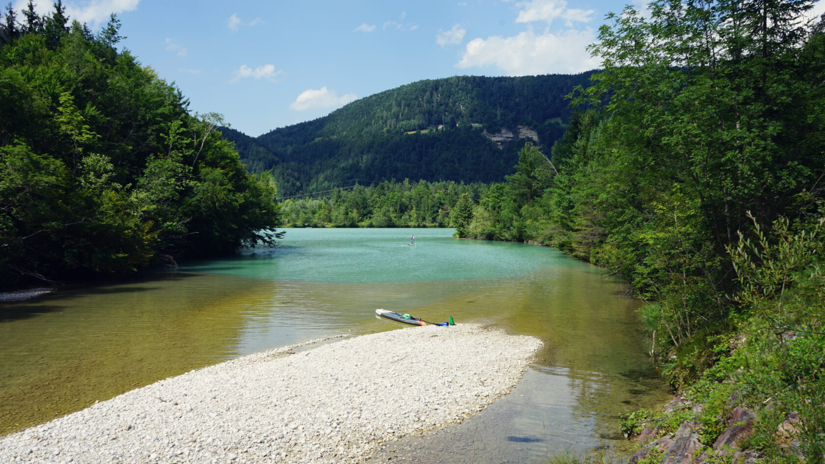
We are aware of the slippery stones on the bank and carefully let the boards slide into the water. The flow speed under the weir is pleasant and initially takes us past the hidden mouth of the Loiblbach Stream and towards the small Valentine's Ferry, which carries visitors from one bank to the other across the 100 m wide river. In between, impressive smaller rock faces and rock formations rise above us on the left, but these are just a foretaste of what is to come.
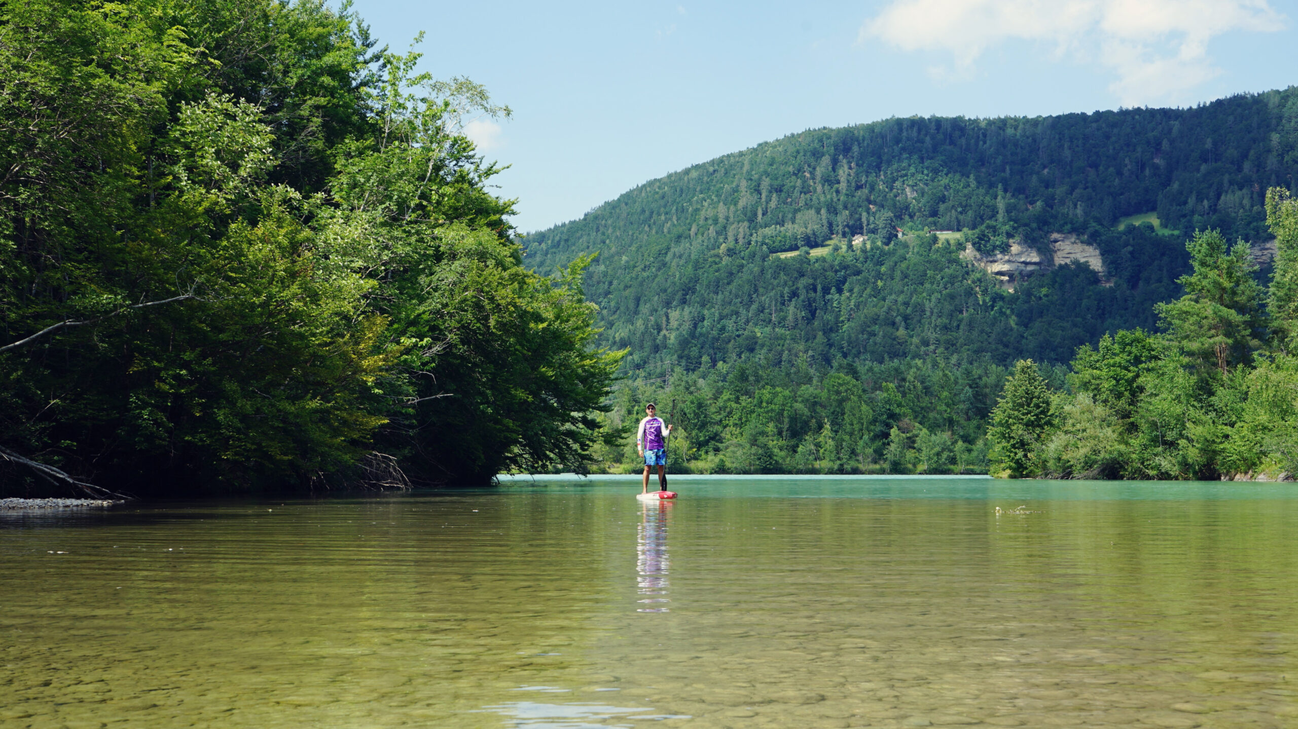
Unfortunately, and as expected, the current does not last long and soon after the ferry it comes to a standstill. In the area of the Guntschacher Au wetlands, the leisurely pace is over for today and we will probably have to paddle properly for the next dozen kilometers to make progress. Opposite the floodplain landscape the small Glainach boat harbor nestles skilfully into the landscape to the right of us. It is one of so many mini marinas on the reservoirs of the Rosental Valley that are so characteristic of the region.
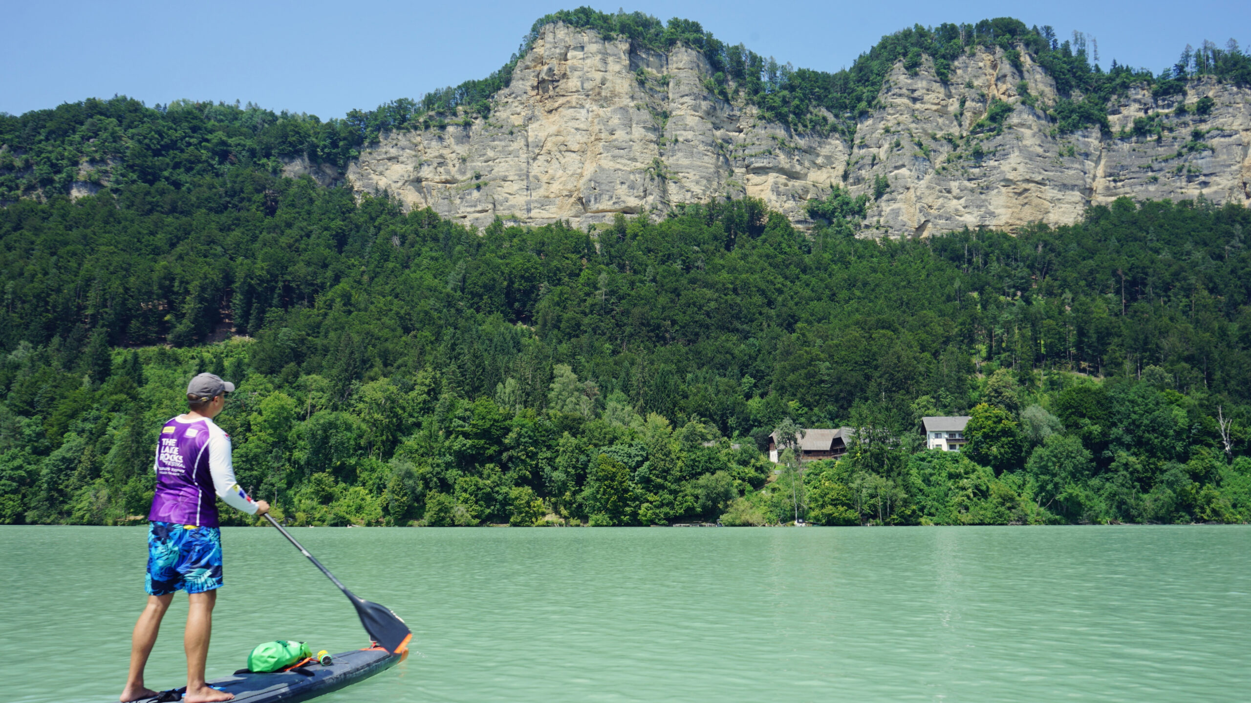
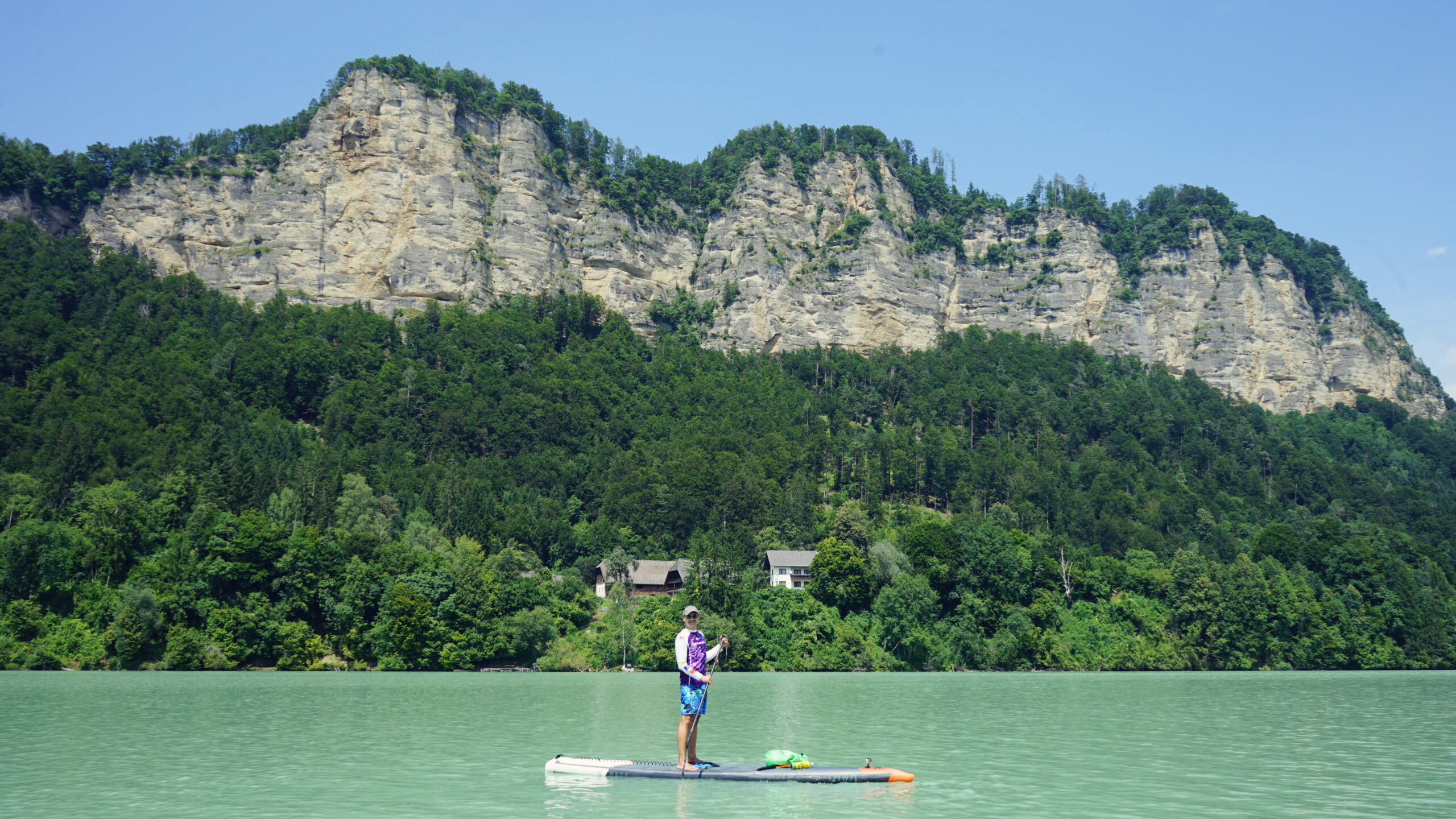
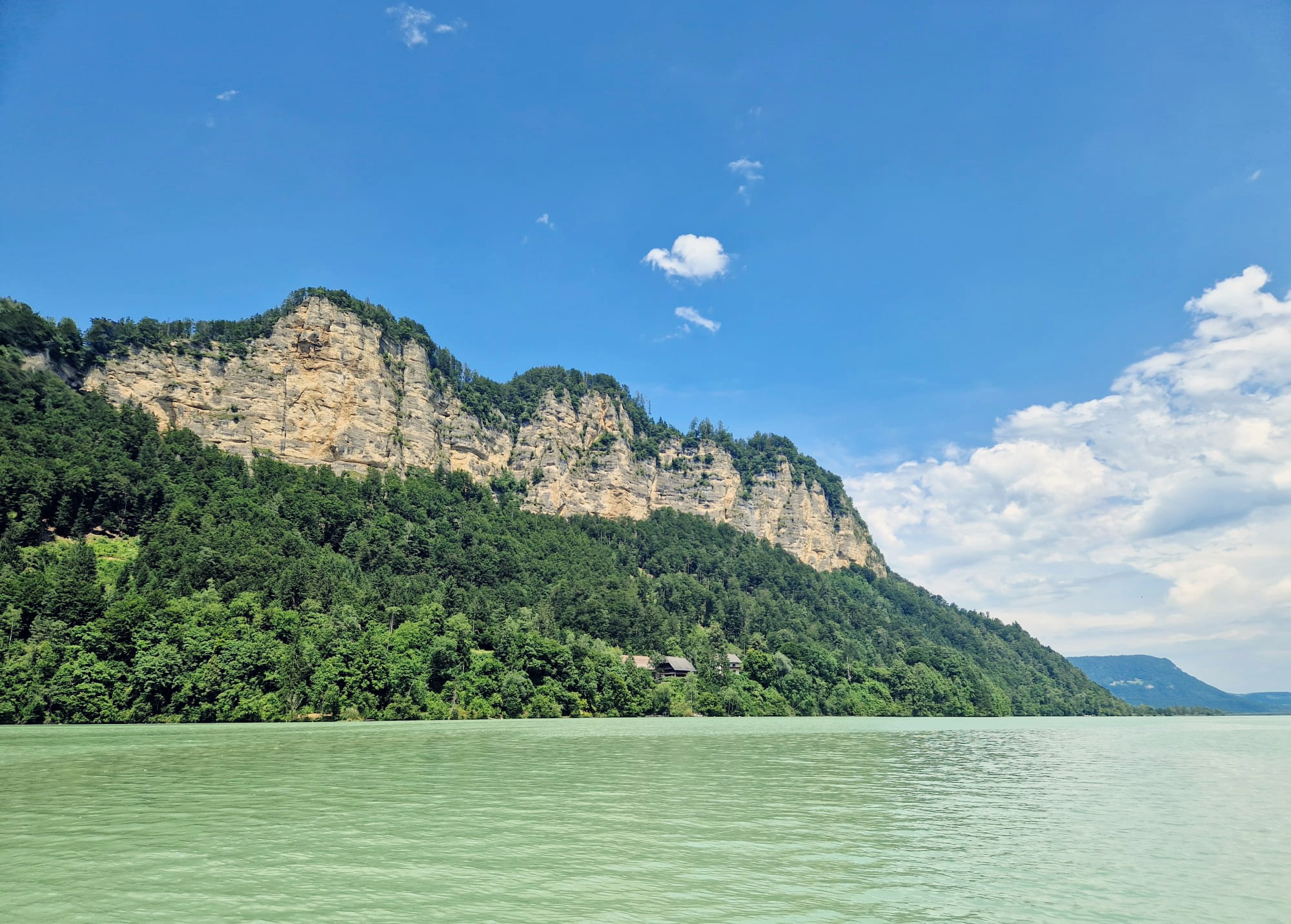
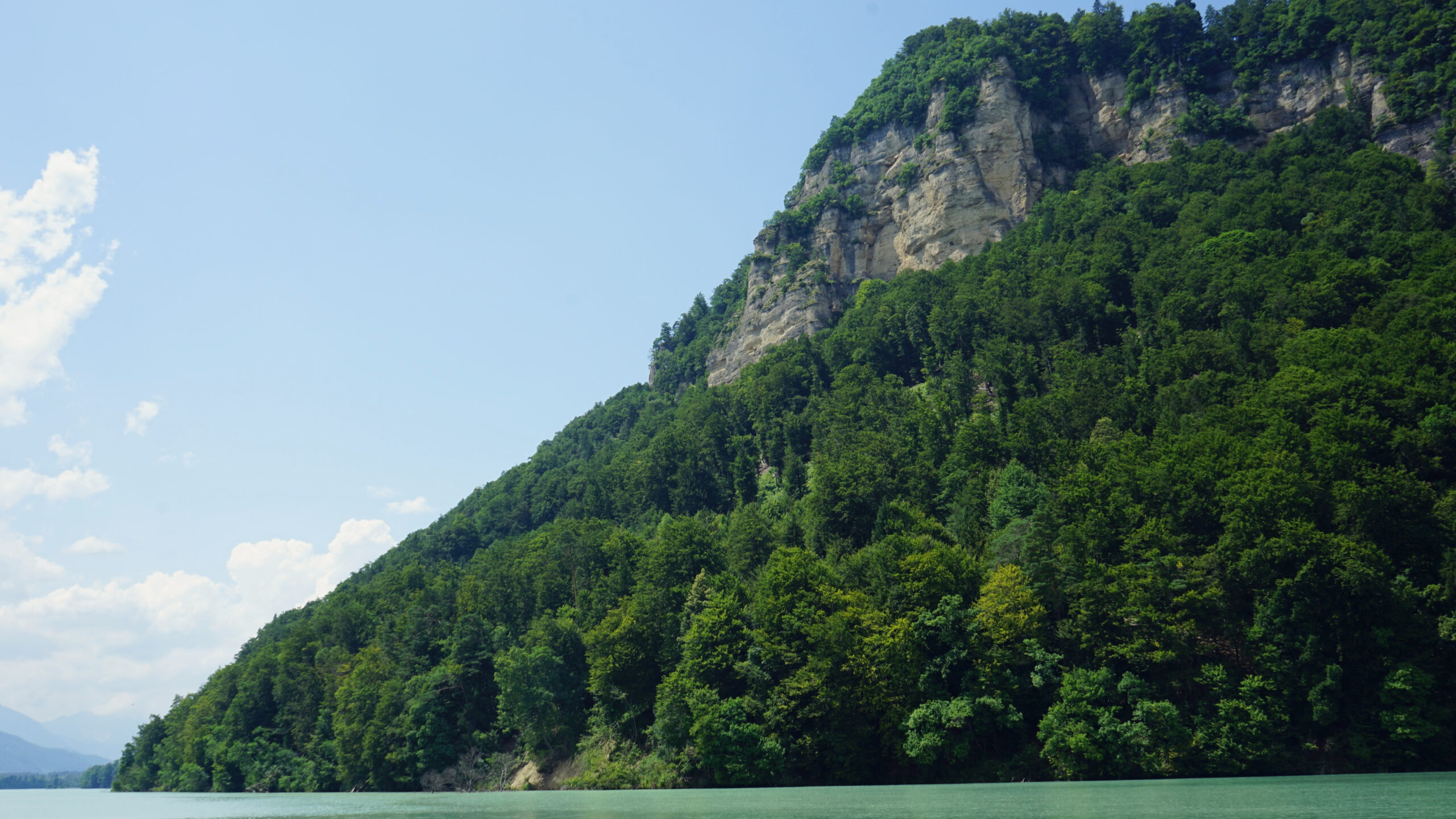
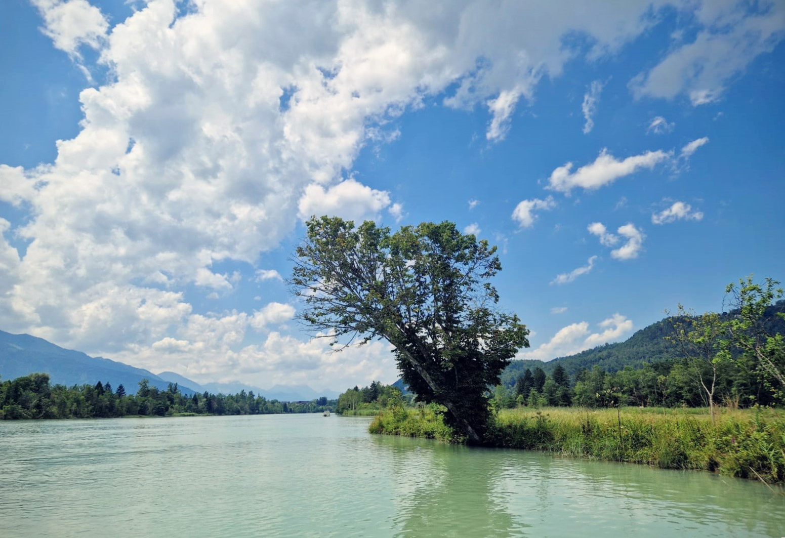
The panorama widens and we see strange-looking plants to our left, some of which protrude from the water individually and look as if they are standing in flower troughs on the water's surface. We are fascinated by this variety of habitats and make a short stop here. However, the Kossiach Rocks also make us look further ahead, as they rise up from their wooded bases like western backdrops, while the right bank of the reservoir is quite unspectacular here. In return, the hinterland towards the Slovenian border offers equally enchanting views. Here you can see gently and symmetrically sloping mountain slopes that flow like sine curves into the plain of the Rosental Valley.


The countless propeller planes above us are striking. They are constantly thundering over us, sometimes in steep descents. No wonder, as the Ferlach-Glainach airfield is not far from the south bank. It is obvious that this private airfield is operated by the local flying club, as we now stop in the middle of the reservoir in front of the dominant rock walls and watch a plane doing daring loops and descents that are burned into our brains like scenes from a war movie.
When the jets start to emit white clouds of smoke and draw traces in the sky, we finally crane our necks. You have to be careful not to lose your balance when the aerial acrobats fly right over your SUP. As impressive as it looks and sounds, after a few minutes we have seen everything and can devote ourselves to paddling and the nature at the reservoir again.
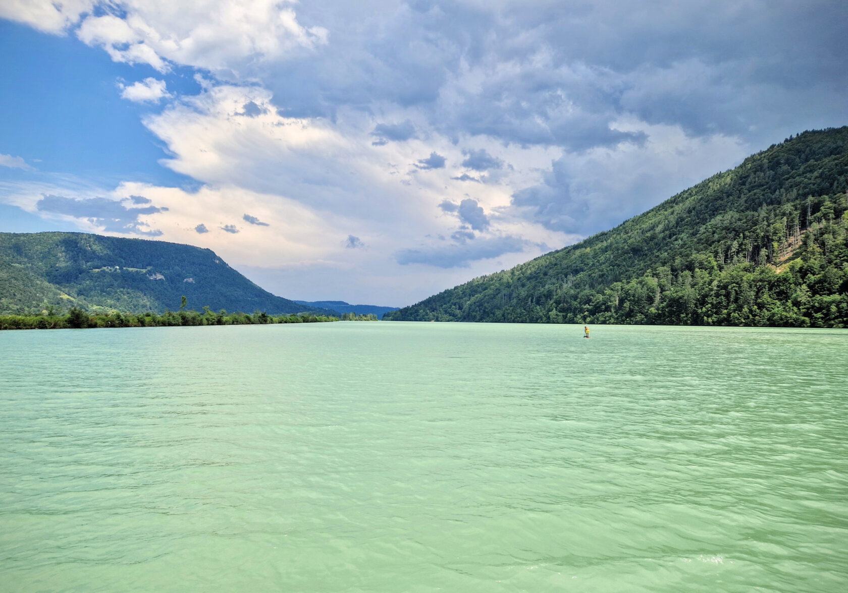
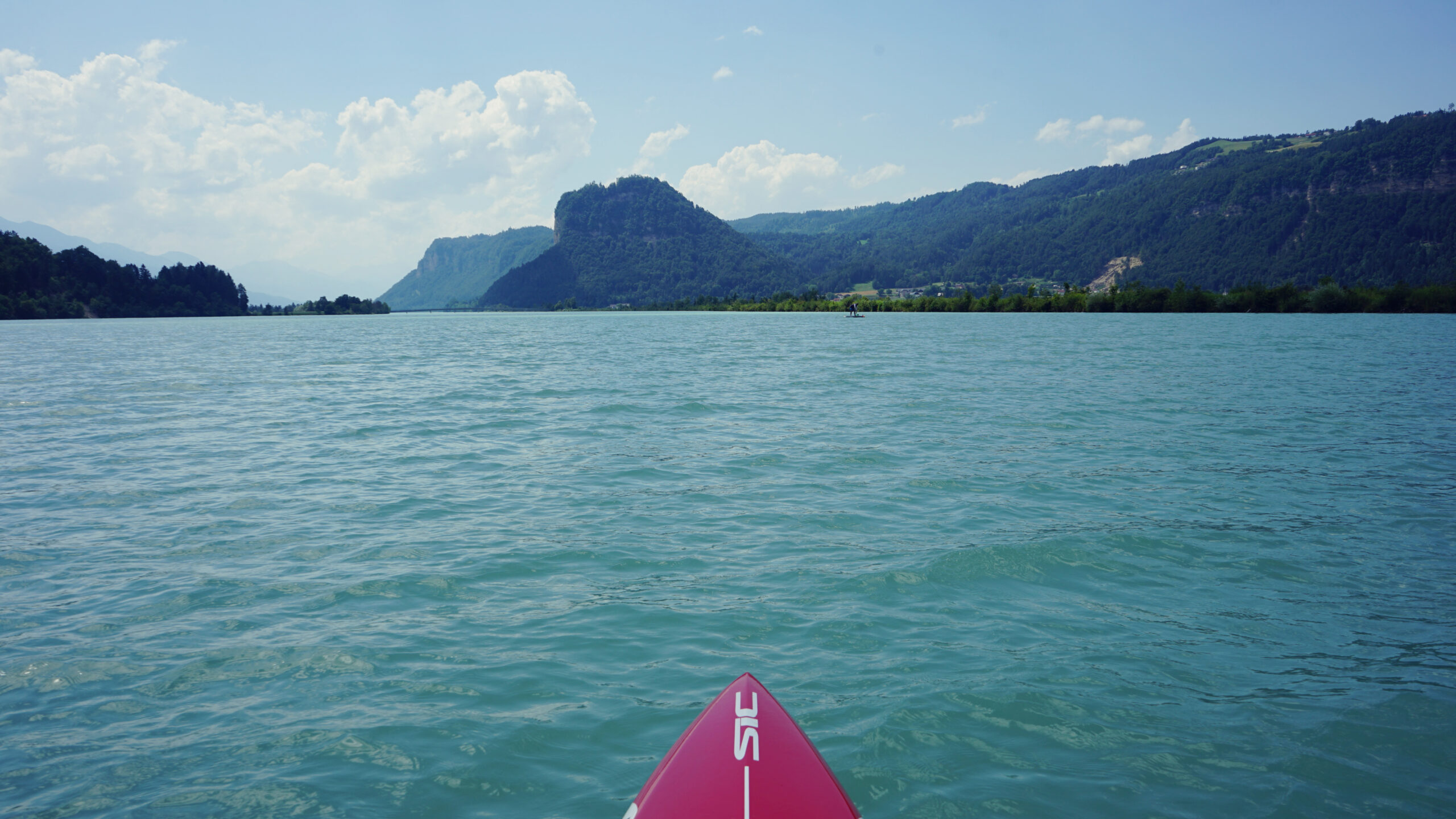
Right in front of the Kossiach Rocks we find wonderful photo opportunities with turquoise, cloudy water and a blue sky. It is always amazing how the Drava manages to create exotic color contrasts in the most diverse places. Because the headwind increases significantly in the early afternoon, we keep heading towards the bank in the hope that the trees and bushes will break the wind a little.
No way! The wind is also blowing on the shore and the waves are hitting us head-on, so luckily we can just cut through them. On the way to the Rottenstein Bridge we avoid the countless fishermen who occupy the left bank by paddling along the southern shore of the reservoir. Above us, the aerial spectacle continues, as paragliders master the winds to skilfully soar around the Wild West rocks.
At the same time, we are keeping an eye on the storm clouds over the Hochobir Mountains, as a thunderstorm was not forecast and would be extremely uncomfortable. There are a few rumbles and flashes of lightning, but then it moves off to the east, giving the sun a chance to shine again.
Before we approach the dam, there are two real must-see spots to be enjoyed. A small island landscape is built up in the water in front of us, which can also be crossed thanks to several waterways. The combination of conifers and reed islands is not something you see every day in such a compact form. Above all, the dark clouds in the background with the bright water of the reservoir create a great atmosphere. And so, lost in thought and with a smile on our faces, we paddle a few hundred meters further when the weir system can already be seen.
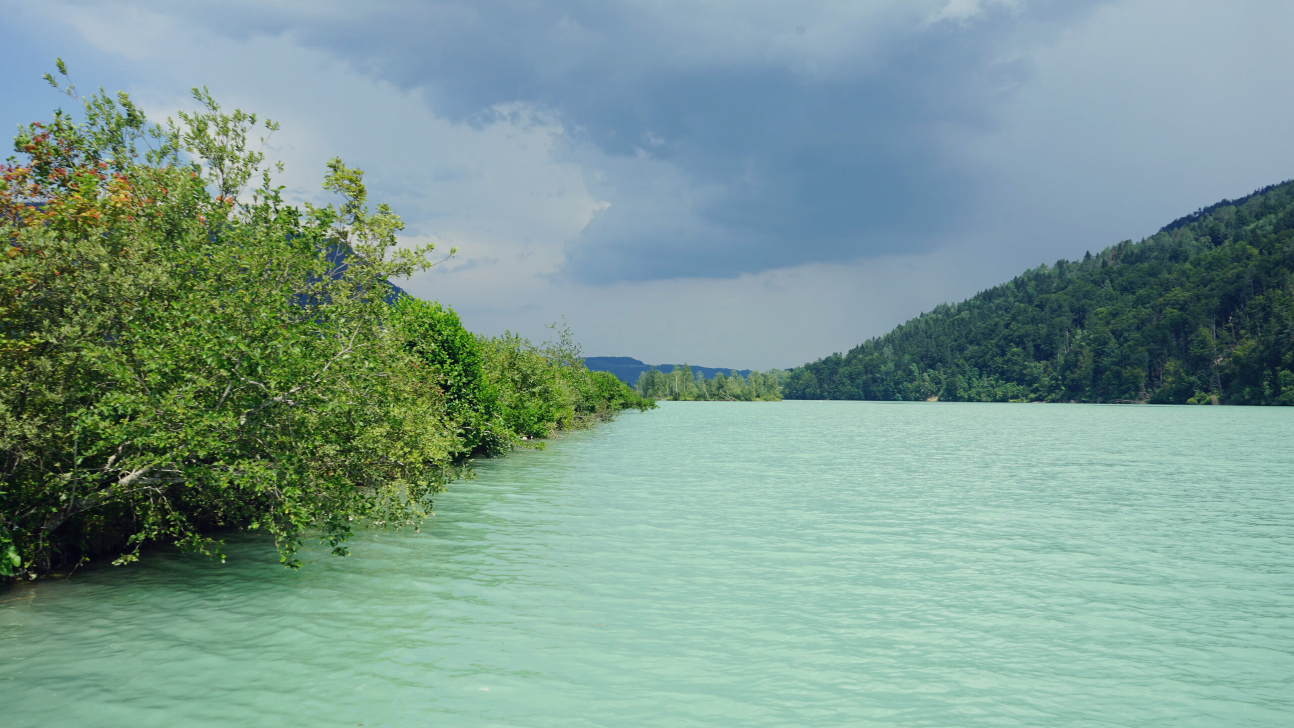
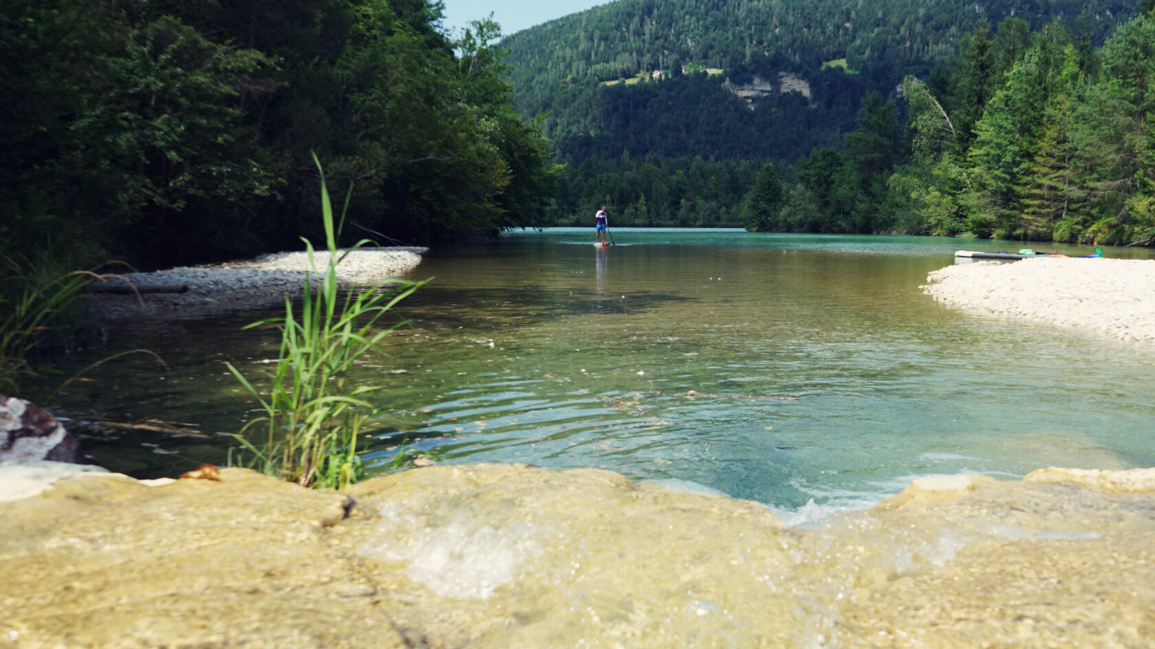
At the same time, however, a bay opens up on the right-hand side, which appears to extend a little deeper into the forest. We paddle towards it and let ourselves drift leisurely around the bend until we discover the Freibach Stream, which flows into the bay over a small waterfall. Here, too, there is a spectacular play of colors, which draws a clear dividing line between the stream basin and the reservoir. The turquoise, murky water suddenly becomes clear and you can see the brownish clay and gravel floor below. We appreciate this magical place for offering us a final break, enjoy the cool water and photograph every conceivable detail.
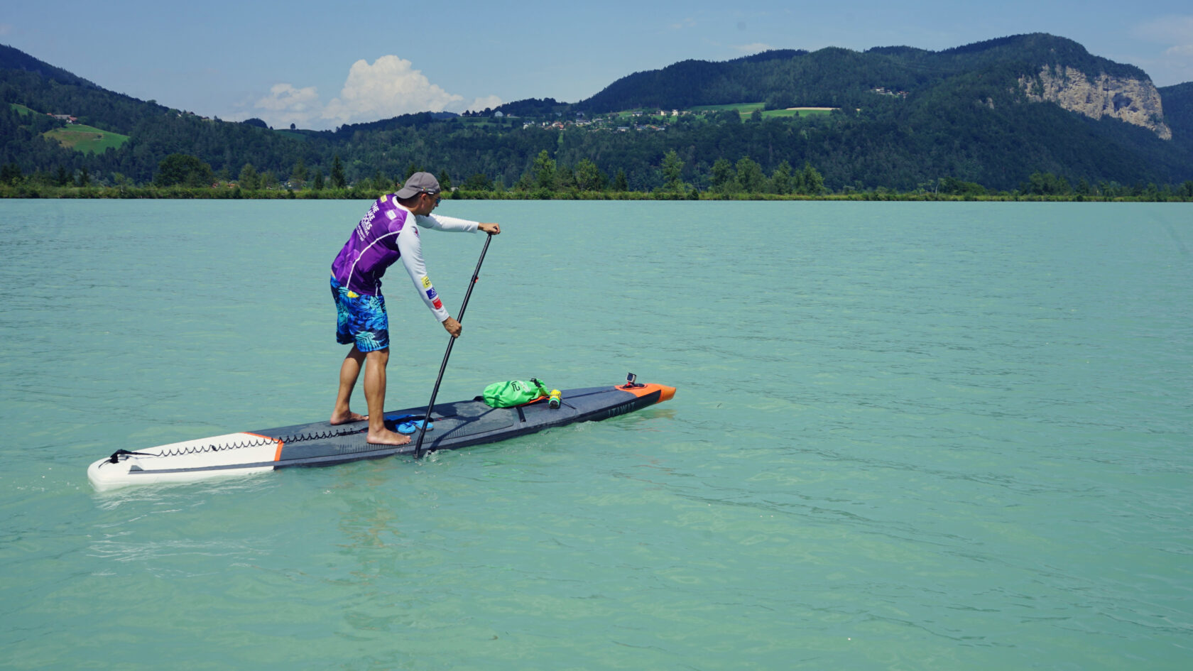
With the energy gained here, we paddle hard against the wind and towards the Annabrücke power station. It can be cycled, which is why it doesn't really matter which side you leave the reservoir on. There is a good option at the very front right by the dam, but this always poses a certain risk. Luckily, we find a suitable spot to land on the left bank a few hundred meters before the weir and carry our SUPs about a meter up to the gravel path at the crest of the dam. Exhausted but happy, we drag our equipment down to the car and agree that we have to paddle here again because this inland sea is addictive.
Alternatives: The reservoir is so huge that you can start at different places and also go on much smaller tours. There is always variety. After the Annabrücke power station you can of course also paddle further along the Drava towards the Völkermarkt Reservoir, and from there on to Slovenia.


Leave a Reply